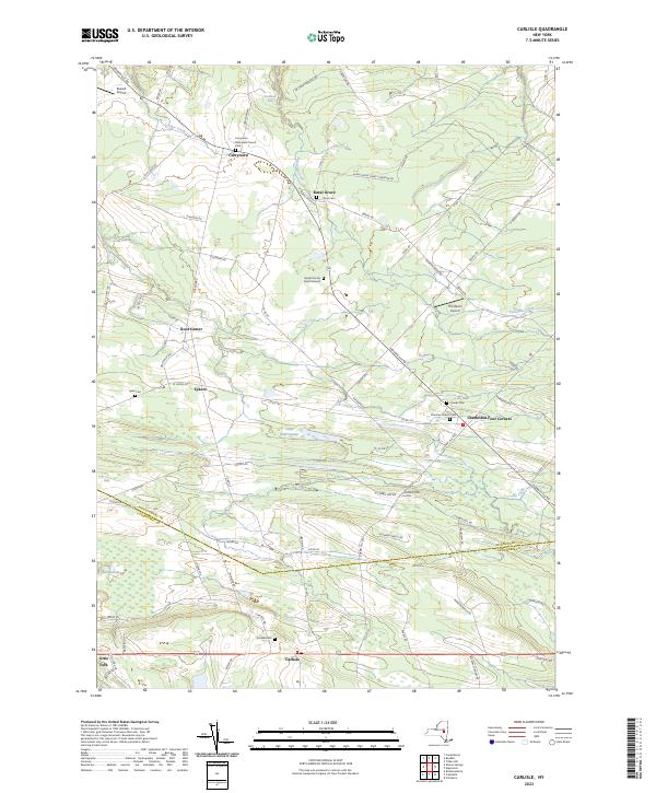
2023 Map of Carlisle
USGS Topo · Published 2023About this map
Currytown and the surrounding rural landscapes of Montgomery and Schoharie counties are defined by a network of historic family properties and small hamlets. The map highlights a strong tradition of local heritage through its numerous burial sites, including the Haight Family Burial Ground and the Gove Cem, alongside institutional landmarks like the Currytown Reformed Church. This area maintains its agricultural character, with secondary roads connecting remote settlements such as Rural Grove, Root Center, and Lykers. The terrain shifts significantly toward the south, dominated by the prominent elevation of Corbin Hill. Hydrography also plays a key role in the local geography, with Yatesville Creek and Lasher Creek cutting through the valleys, while the wetlands of Little Bear Swamp and Bear Swamp occupy the low-lying reaches between the ridges. Small aviation facilities like The Ranch Airport and Russell Airport suggest the modern usage of these open rural spaces.
Find a feature on this map
86 named features on this map. Tap any name to fly to it.
Don’t see what you’re looking for? This feature index may not catch every label — zoom into the map to look around manually.
Map Details
Editions of this 2023 Carlisle Map
This is the sole edition of this map. No revisions or reprints were ever made.
Other maps of this area

1896 · Fonda
USGS Topo · 1:62,500

1898 · Fonda
USGS Topo · 1:62,500

1898 · Canajoharie
USGS Topo · 1:62,500

1898 · Schoharie
USGS Topo · 1:62,500

1900 · Canajoharie
USGS Topo · 1:62,500

1900 · Schoharie
USGS Topo · 1:62,500

1900 · Schoharie
USGS Topo · 1:31,680

1902 · Canajoharie
USGS Topo · 1:62,500

1902 · Fonda
USGS Topo · 1:62,500

1904 · Richmondville
USGS Topo · 1:62,500