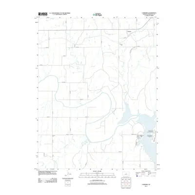
2012 Map of Carneiro
USGS Topo · Published 2012About this map
Carneiro serves as the focal point for this Central Kansas landscape, where the prairie transitions into the drainage basins of the Smoky Hill River and its tributaries. The terrain is marked by distinctive geological features, notably the unique formations within Mushroom Rock State Park. To the south, the expansion of Kanopolis Lake has altered the historic shoreline, creating a recreational corridor that includes Kanopolis State Park Eagle Point Campground and the Rockin' K Horse Campground at Kanopolis State Park. Local history is anchored by the Carneiro Cem and the more distant Buckeye Cem, while the water network is defined by the winding paths of Clear Cr, Alum Cr, and Thompson Cr. The map details a grid of rural avenues and roads that connect the dispersed settlement of Yankee Run to the larger surrounding agricultural landscape.
Find a feature on this map
36 named features on this map. Tap any name to fly to it.
Don’t see what you’re looking for? This feature index may not catch every label — zoom into the map to look around manually.
Map Details
Editions of this 2012 Carneiro Map
This is the sole edition of this map. No revisions or reprints were ever made.
Other maps of this area

1892 · Salina
USGS Topo · 1:125,000

1894 · Ellsworth
USGS Topo · 1:125,000

1942 · Salina
USGS Topo · 1:125,000

1955 · Great Bend
USGS Topo · 1:250,000

1955 · Hutchinson
USGS Topo · 1:250,000

1957 · Great Bend
USGS Topo · 1:250,000

1957 · Ellsworth
USGS Topo · 1:24,000

1957 · Westfall SW
USGS Topo · 1:24,000

1957 · Brookville SW
USGS Topo · 1:24,000

1957 · Westfall SE
USGS Topo · 1:24,000