
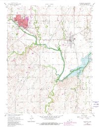
1957 Map of Ellsworth
USGS Topo · Published 1958About this map
Kanopolis and the larger seat of Ellsworth serve as the primary hubs in this mid-century portrait of Central Kansas. The landscape is defined by the winding course of the Smoky Hill River, which is fed by numerous tributaries including Oak Creek, Mud Creek, and Oxide Creek. Transportation networks are heavily represented here, showing the convergence of the Union Pacific, Missouri Pacific, and St Louis San Francisco railroads. This infrastructure supported a diverse community, evidenced by institutions like the St Francis Boys Home, the Good Samaritan Home, and the local Ellsworth Airport. Farther south, the terrain becomes more dissected as it transitions toward Ash Creek and the Empire district, where more isolated landmarks such as School No 84 reflect the rural educational patterns of the era.
Find a feature on this map
25 named features on this map. Tap any name to fly to it.
Don’t see what you’re looking for? This feature index may not catch every label — zoom into the map to look around manually.
Map Details
Editions of this 1957 Ellsworth Map
2 editions found
Other maps of this area

1894 · Ellsworth
USGS Topo · 1:125,000

1955 · Great Bend
USGS Topo · 1:250,000

1957 · Great Bend
USGS Topo · 1:250,000

1957 · Westfall SW
USGS Topo · 1:24,000

1957 · Westfall SE
USGS Topo · 1:24,000
1957 · Carneiro
USGS Topo · 1:24,000

1957 · Holyrood NE
USGS Topo · 1:24,000

1957 · Black Wolf
USGS Topo · 1:24,000

1958 · Great Bend
USGS Topo · 1:250,000
1964 · Crawford
USGS Topo · 1:24,000