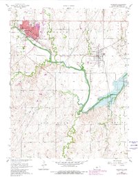
1957 Map of Ellsworth
USGS Topo · Published 1980About this map
The Smoky Hill River winds through this central Kansas landscape, defining the corridor for both the Union Pacific and Missouri Pacific railroads. In the late 1950s, the town of Ellsworth serves as a local hub, featuring the Ellsworth Airport and institutional landmarks like the St Francis Boys Home and the Good Samaritan Home. The 1970s photorevisions shown in purple indicate expanding residential footprints and the development of a Trailer Park near the river's edge.
Find a feature on this map
25 named features on this map. Tap any name to fly to it.
Don’t see what you’re looking for? This feature index may not catch every label — zoom into the map to look around manually.
Map Details
Editions of this 1957 Ellsworth Map
2 editions found
Other maps of this area

1894 · Ellsworth
USGS Topo · 1:125,000

1955 · Great Bend
USGS Topo · 1:250,000

1957 · Great Bend
USGS Topo · 1:250,000

1957 · Ellsworth
USGS Topo · 1:24,000

1957 · Westfall SW
USGS Topo · 1:24,000

1957 · Westfall SE
USGS Topo · 1:24,000
1957 · Carneiro
USGS Topo · 1:24,000

1957 · Holyrood NE
USGS Topo · 1:24,000

1957 · Black Wolf
USGS Topo · 1:24,000

1958 · Great Bend
USGS Topo · 1:250,000