
1957 Map of Holyrood NE
USGS Topo · Published 1958About this map
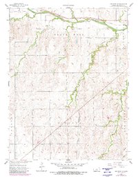
The Smoky Hill River carves a broad valley across the northern reaches of this Ellsworth County landscape, serving as a primary corridor for early transportation and settlement. Paralleling the river, the Union Pacific railroad tracks follow the natural grade, while the San Francisco St Louis and line cuts diagonally through the southern sections of Lincoln and Ellsworth townships. The map illustrates a transition from the riparian lowlands to the elevated, dissected plateaus of the Black Wolf region.
Find a feature on this map
11 named features on this map. Tap any name to fly to it.
Don’t see what you’re looking for? This feature index may not catch every label — zoom into the map to look around manually.
Map Details
Editions of this 1957 Holyrood NE Map
2 editions found
Other maps of this area

1894 · Ellsworth
USGS Topo · 1:125,000

1955 · Great Bend
USGS Topo · 1:250,000

1956 · Wilson
USGS Topo · 1:24,000

1957 · Great Bend
USGS Topo · 1:250,000

1957 · Ellsworth
USGS Topo · 1:24,000

1957 · Westfall SW
USGS Topo · 1:24,000

1957 · Black Wolf
USGS Topo · 1:24,000

1958 · Great Bend
USGS Topo · 1:250,000
1964 · Holyrood NW
USGS Topo · 1:24,000
1964 · Holyrood
USGS Topo · 1:24,000