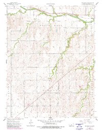
1957 Map of Holyrood NE
USGS Topo · Published 1980About this map
The Smoky Hill River carves a significant path across this portion of Ellsworth County, defining the local topography and historical transportation corridors. Parallel to the river, the Union Pacific railroad tracks follow the northern bank, a vital link for the agricultural heartland of central Kansas during the mid-twentieth century. Further south, the St Louis San Francisco rail line cuts through the prairie, crossing several drainage systems that feed into the main river valley.
Find a feature on this map
13 named features on this map. Tap any name to fly to it.
Don’t see what you’re looking for? This feature index may not catch every label — zoom into the map to look around manually.
Map Details
Editions of this 1957 Holyrood NE Map
2 editions found
Other maps of this area

1894 · Ellsworth
USGS Topo · 1:125,000

1955 · Great Bend
USGS Topo · 1:250,000

1956 · Wilson
USGS Topo · 1:24,000

1957 · Great Bend
USGS Topo · 1:250,000

1957 · Ellsworth
USGS Topo · 1:24,000

1957 · Westfall SW
USGS Topo · 1:24,000

1957 · Holyrood NE
USGS Topo · 1:24,000

1957 · Black Wolf
USGS Topo · 1:24,000

1958 · Great Bend
USGS Topo · 1:250,000
1964 · Holyrood NW
USGS Topo · 1:24,000