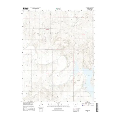
2015 Map of Carneiro
USGS Topo · Published 2015About this map
The settlement of Carneiro sits in the northern reaches of this central Kansas landscape, where the prairie meets the drainage systems of the Smoky Hill River. The topography is defined by the carved paths of Alum Cr and Clear Cr, which flow south toward the river valley. The southern portion of the map is dominated by the expansive waters of Kanopolis Lake, which altered the historical flow of the river and submerged portions of the valley. Local history and genealogy are anchored by established burial grounds like Carneiro Cem and Buckeye Cem. The map illustrates a strictly organized grid of rural roads, such as Yankee Run Rd and Avenue N, which provide access to the various creek basins including Thompson Creek and W Spring Cr.
Find a feature on this map
29 named features on this map. Tap any name to fly to it.
Don’t see what you’re looking for? This feature index may not catch every label — zoom into the map to look around manually.
Map Details
Editions of this 2015 Carneiro Map
This is the sole edition of this map. No revisions or reprints were ever made.
Other maps of this area

1892 · Salina
USGS Topo · 1:125,000

1894 · Ellsworth
USGS Topo · 1:125,000

1942 · Salina
USGS Topo · 1:125,000

1955 · Great Bend
USGS Topo · 1:250,000

1955 · Hutchinson
USGS Topo · 1:250,000

1957 · Great Bend
USGS Topo · 1:250,000

1957 · Ellsworth
USGS Topo · 1:24,000

1957 · Westfall SW
USGS Topo · 1:24,000

1957 · Brookville SW
USGS Topo · 1:24,000

1957 · Westfall SE
USGS Topo · 1:24,000