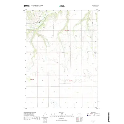
2017 Map of Carns
USGS Topo · Published 2017About this map
Niobrara River waters flow eastward through the northern section of this landscape, defining the boundary between Keya Paha Co and Rock Co. The waterway is protected as the Niobrara National Scenic River, a corridor marked by steep bluffs and complex drainage networks. Historically significant crossings like the Carns Bridge connect the river's banks, while the upland areas are dissected by numerous tributaries including Coon Cr, Middle Br, and both branches of Laughing Water Cr.
Find a feature on this map
32 named features on this map. Tap any name to fly to it.
Don’t see what you’re looking for? This feature index may not catch every label — zoom into the map to look around manually.
Map Details
Editions of this 2017 Carns Map
This is the sole edition of this map. No revisions or reprints were ever made.
Other maps of this area

1949 · Jamison SW
USGS Topo · 1:24,000

1949 · Riverview
USGS Topo · 1:24,000

1949 · Carns
USGS Topo · 1:24,000

1950 · Carns
USGS Topo · 1:24,000

1950 · Riverview
USGS Topo · 1:24,000

1950 · Mariaville
USGS Topo · 1:24,000

1951 · Jamison SW
USGS Topo · 1:24,000

1954 · Newport NE
USGS Topo · 1:24,000

1954 · Bassett
USGS Topo · 1:24,000

1954 · Newport
USGS Topo · 1:24,000