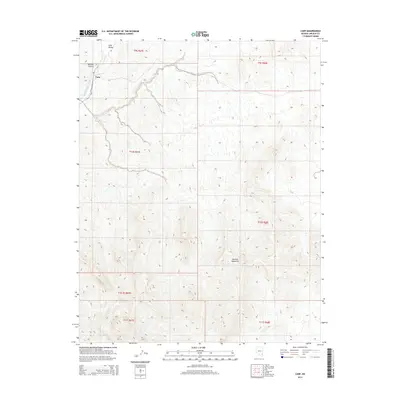
2014 Map of Carp
USGS Topo · Published 2014About this map
Carp serves as the focal point of this Lincoln County survey, situated where the Moapa Rd meets the perennial course of the Meadow Valley Wash. The landscape is dominated by the massive rise of the Mormon Mountains to the south and east, with their drainage systems carving deep relief into the terrain. Significant landforms like Mormon Canyon and Long Valley define the northern reaches of the quadrangle, illustrating the complex hydrology of this arid region. The map meticulously documents the township and range grid system across a vast, sparsely settled area, showing how transport routes were dictated by the natural corridors of the washes and valleys. This 2014 edition provides a high-resolution look at the geographic isolation and topography of the eastern Nevada wilderness before modern expansion.
Find a feature on this map
13 named features on this map. Tap any name to fly to it.
Don’t see what you’re looking for? This feature index may not catch every label — zoom into the map to look around manually.
Map Details
Editions of this 2014 Carp Map
This is the sole edition of this map. No revisions or reprints were ever made.
Other maps of this area

1885 · Pioche
USGS Topo · 1:250,000

1886 · Saint Thomas
USGS Topo · 1:250,000

1886 · Pioche
USGS Topo · 1:250,000

1893 · Saint Thomas
USGS Topo · 1:250,000

1954 · Caliente
USGS Topo · 1:250,000

1954 · Las Vegas
USGS Topo · 1:250,000

1957 · Las Vegas
USGS Topo · 1:250,000

1959 · Caliente
USGS Topo · 1:250,000

1959 · Las Vegas
USGS Topo · 1:250,000

1962 · Las Vegas
USGS Topo · 1:250,000