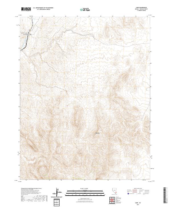
2021 Map of Carp
USGS Topo · Published 2021About this map
Carp is the primary settlement on this map of southeastern Nevada, situated where the high desert terrain meets the Meadow Valley Wash. The landscape is dominated by the massive rise of the Mormon Mountains to the south and east, creating a corridor for drainage and travel through the Mormon Canyon and into Long Valley. This area represents a critical transit point in the desert, where CO Rte 4230 parallels the seasonal watercourse. The map details a complex network of township and range lines, including t9s r67e and t11s r68e, which define the ranching and public land boundaries in this arid portion of Lincoln County. The proximity of the wash to the settlement at Carp suggests the historic importance of reliable water sources in the development of the region's scattered outposts.
Find a feature on this map
13 named features on this map. Tap any name to fly to it.
Don’t see what you’re looking for? This feature index may not catch every label — zoom into the map to look around manually.
Map Details
Editions of this 2021 Carp Map
This is the sole edition of this map. No revisions or reprints were ever made.
Other maps of this area

1885 · Pioche
USGS Topo · 1:250,000

1886 · Saint Thomas
USGS Topo · 1:250,000

1886 · Pioche
USGS Topo · 1:250,000

1893 · Saint Thomas
USGS Topo · 1:250,000

1954 · Caliente
USGS Topo · 1:250,000

1954 · Las Vegas
USGS Topo · 1:250,000

1957 · Las Vegas
USGS Topo · 1:250,000

1959 · Caliente
USGS Topo · 1:250,000

1959 · Las Vegas
USGS Topo · 1:250,000

1962 · Las Vegas
USGS Topo · 1:250,000