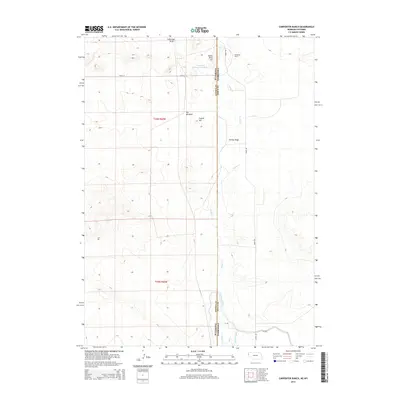
2014 Map of Carpenter Ranch
USGS Topo · Published 2014About this map
The high plains of the Wyoming-Nebraska border define this landscape, where the Goshen and Sioux County line cuts through a ranching and irrigation corridor. Central to the area is the Carpenter Ranch, supported by water management features like the Carpenter Reservoir Number 1 and the Interstate Canal. The terrain is marked by distinct rises such as Indian River Hill and Coyote Hill, while the drainage of Sheep Cr and George Draw shapes the local topography. This 2014 survey illustrates the continued importance of water infrastructure in the arid West, seen in the presence of Hill Windmill and the precise engineering of Lateral Number 4. The map provides a clear record of the rural road network, including Road 94 and Henry Rd, which connect these remote ranching operations.
Find a feature on this map
17 named features on this map. Tap any name to fly to it.
Don’t see what you’re looking for? This feature index may not catch every label — zoom into the map to look around manually.
Map Details
Editions of this 2014 Carpenter Ranch Map
This is the sole edition of this map. No revisions or reprints were ever made.
Other maps of this area

1896 · Patrick
USGS Topo · 1:125,000

1899 · Whistle Creek
USGS Topo · 1:125,000

1954 · Torrington
USGS Topo · 1:250,000

1955 · Alliance
USGS Topo · 1:250,000

1957 · Alliance
USGS Topo · 1:250,000

1958 · Torrington
USGS Topo · 1:250,000

1958 · Alliance
USGS Topo · 1:250,000

1963 · Chalk Buttes
USGS Topo · 1:24,000
1963 · Torrington SE
USGS Topo · 1:24,000

1963 · Tea Kettle Rock
USGS Topo · 1:24,000