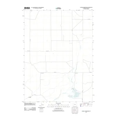
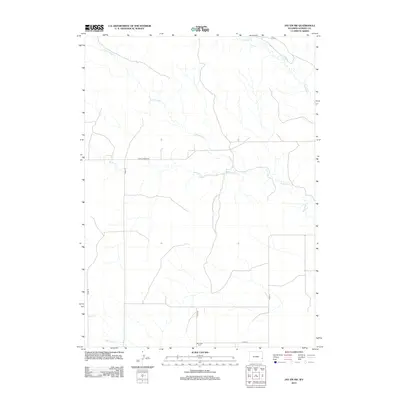
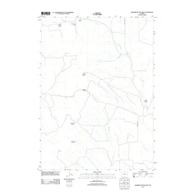
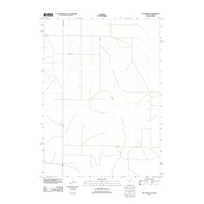
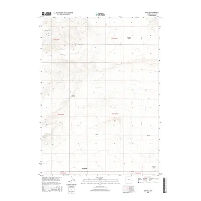
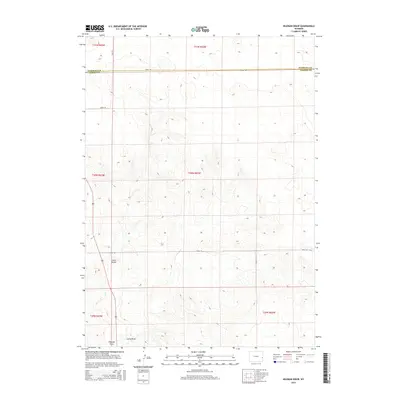
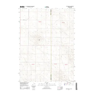
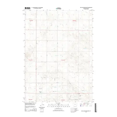
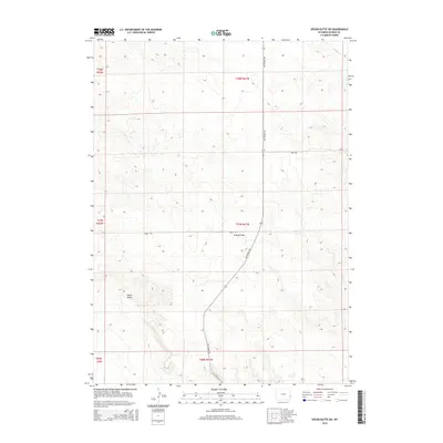
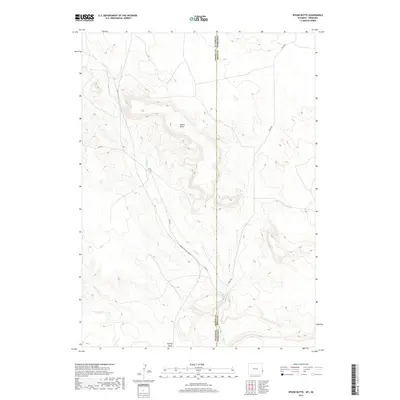
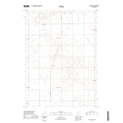
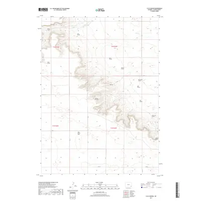
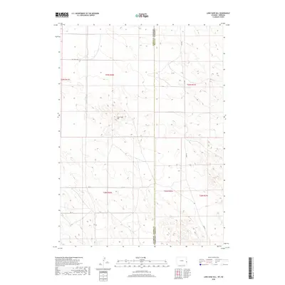
1963 Map of Tea Kettle Rock
USGS Topo · Published 1965About this map
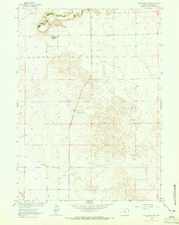
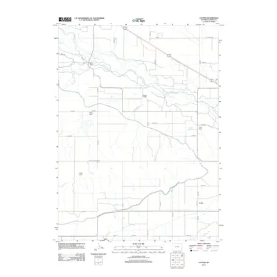
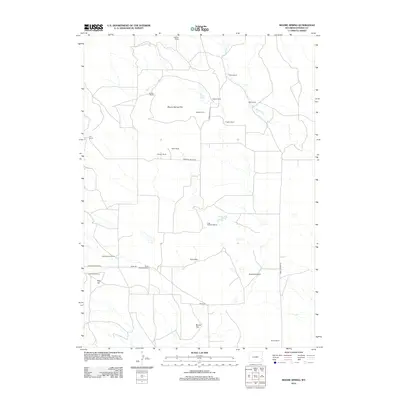
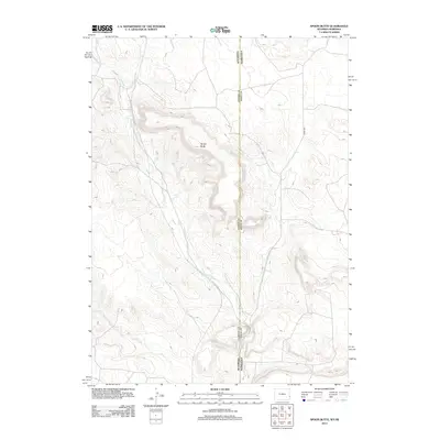
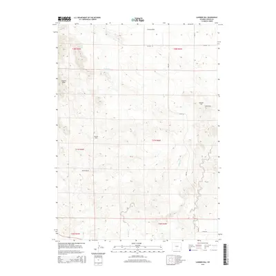
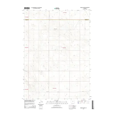
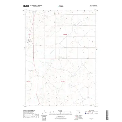
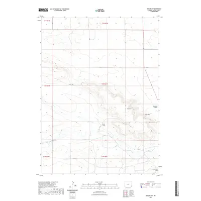
Tea Kettle Rock and the high ground of Ninemile Hill dominate this Goshen County landscape as it appeared in the early 1960s. Surveyed as part of the Department of the Interior program for the development of the Missouri River Basin, the map illustrates a sparsely settled region defined by its topography and industrial utility. A single Landing Strip and the unimproved track of Tea Kettle Rock Road provide the primary transportation infrastructure for the area. The presence of a Sandpit and a marked Well suggest localized resource extraction and water management in this high plains environment. The terrain is carefully detailed with twenty-foot contours, showing the complex drainage patterns and elevation changes across the township lines of T. 26 N. and T. 25 N.
Find a feature on this map
7 named features on this map. Tap any name to fly to it.
Don’t see what you’re looking for? This feature index may not catch every label — zoom into the map to look around manually.
Map Details
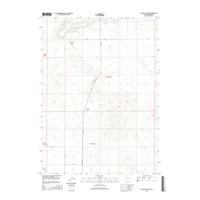
Editions of this 1963 Tea Kettle Rock Map
2 editions found
Historical Maps of Goshen County Through Time
180 maps found

1896 Patrick
Goshen County, WY

1899 Goshen Hole
Goshen County, WY

1950 Casebier Hill
Goshen County, WY

1950 Rockeagle
Goshen County, WY

1951 Moore Spring
Goshen County, WY

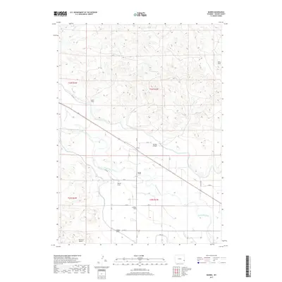
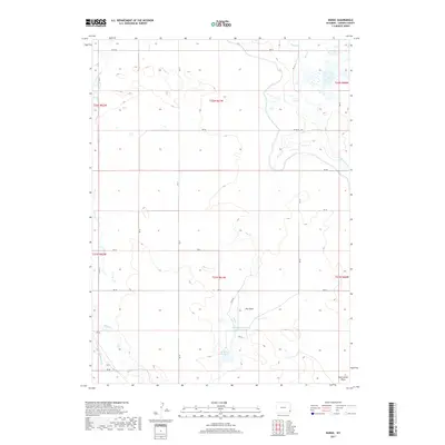
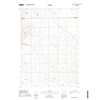
1960 Barnes
Goshen County, WY

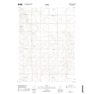
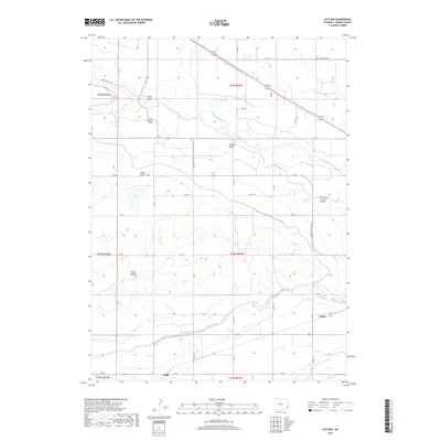
1960 Cottier
Goshen County, WY

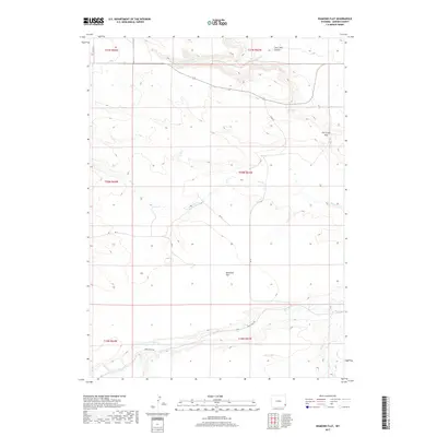
1960 Diamond Flat
Goshen County, WY

1960 Duroc
Goshen County, WY

1960 Habig Spring
Goshen County, WY

1960 Kessler Gap
Goshen County, WY

1960 Mc Compsey Pass
Goshen County, WY

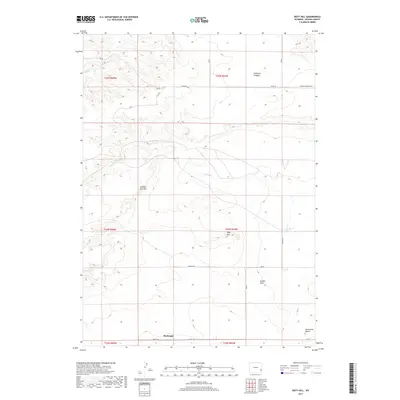
1960 Needle Rock
Goshen County, WY

1960 Robb Draw
Goshen County, WY

1963 Carpenter Ranch
Goshen County, WY

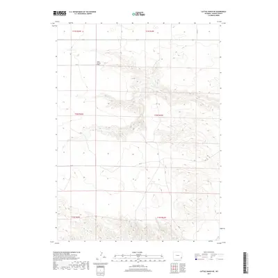
1963 Cattail Ranch NE
Goshen County, WY

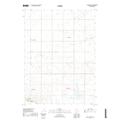
1963 Glomill Reservoir
Goshen County, WY

1963 Tea Kettle Rock
Goshen County, WY

1963 Torrington SE
Goshen County, WY

1963 Y B O Canyon
Goshen County, WY

1968 Glomill Reservoir
Goshen County, WY

1974 Jay Em
Goshen County, WY

1974 Jay Em NW
Goshen County, WY

1974 Rawhide Buttes East
Goshen County, WY

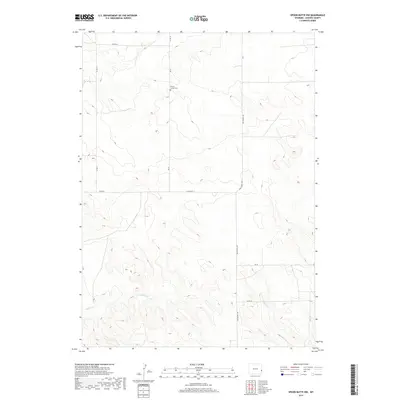
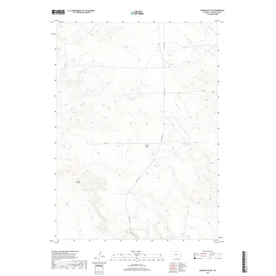
1974 Spoon Butte
Goshen County, WY

1974 Spoon Butte SW
Goshen County, WY

1977 Hileman Draw
Goshen County, WY

1977 Prairie Center
Goshen County, WY

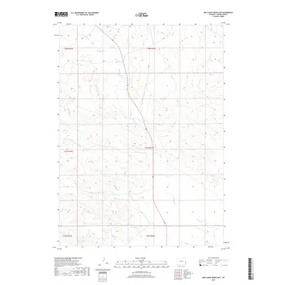
1977 Red Cloud Creek East
Goshen County, WY

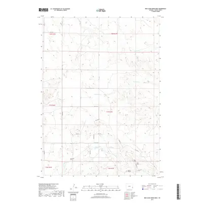
1977 Red Cloud Creek West
Goshen County, WY

1977 Spoon Butte NW
Goshen County, WY

1977 Van Tassell SE
Goshen County, WY

1978 Lone Sand Hill
Goshen County, WY

1978 Rawhide Buttes West
Goshen County, WY

1990 Barnes
Goshen County, WY

1990 Casebier Hill
Goshen County, WY

1990 Cattail Ranch NE
Goshen County, WY

1990 Cottier
Goshen County, WY

1990 Diamond Flat
Goshen County, WY

1990 Doty Hill
Goshen County, WY

1990 Duroc
Goshen County, WY

1990 Glomill Reservoir
Goshen County, WY

1990 Habig Spring
Goshen County, WY

1990 Jay Em
Goshen County, WY

1990 Jay Em NW
Goshen County, WY

1990 Kessler Gap
Goshen County, WY

1990 Lone Sand Hill
Goshen County, WY

1990 Mc Compsey Pass
Goshen County, WY

1990 Moore Spring
Goshen County, WY

1990 Needle Rock
Goshen County, WY

1990 Red Cloud Creek East
Goshen County, WY

1990 Red Cloud Creek West
Goshen County, WY

1990 Robb Draw
Goshen County, WY

1990 Spoon Butte
Goshen County, WY

1990 Spoon Butte NW
Goshen County, WY

1990 Spoon Butte SW
Goshen County, WY

1990 Tea Kettle Rock
Goshen County, WY

1990 Torrington SE
Goshen County, WY

1990 Y B O Canyon
Goshen County, WY
2012 Barnes
Goshen County, WY
2012 Casebier Hill
Goshen County, WY
2012 Cattail Ranch NE
Goshen County, WY
2012 Cottier
Goshen County, WY
2012 Diamond Flat
Goshen County, WY
2012 Doty Hill
Goshen County, WY
2012 Duroc
Goshen County, WY
2012 Glomill Reservoir
Goshen County, WY
2012 Habig Spring
Goshen County, WY
2012 Hileman Draw
Goshen County, WY
2012 Jay Em
Goshen County, WY
2012 Jay Em NW
Goshen County, WY
2012 Kessler Gap
Goshen County, WY
2012 Lone Sand Hill
Goshen County, WY
2012 McCompsey Pass
Goshen County, WY
2012 Moore Spring
Goshen County, WY
2012 Needle Rock
Goshen County, WY
2012 Prairie Center
Goshen County, WY
2012 Rawhide Buttes East
Goshen County, WY
2012 Rawhide Buttes West
Goshen County, WY
2012 Red Cloud Creek East
Goshen County, WY
2012 Red Cloud Creek West
Goshen County, WY
2012 Robb Draw
Goshen County, WY
2012 Spoon Butte
Goshen County, WY
2012 Spoon Butte NW
Goshen County, WY
2012 Spoon Butte SW
Goshen County, WY
2012 Tea Kettle Rock
Goshen County, WY
2012 Torrington SE
Goshen County, WY
2012 Van Tassell SE
Goshen County, WY
2012 Y B O Canyon
Goshen County, WY
2015 Barnes
Goshen County, WY
2015 Casebier Hill
Goshen County, WY
2015 Cattail Ranch NE
Goshen County, WY
2015 Cottier
Goshen County, WY
2015 Diamond Flat
Goshen County, WY
2015 Doty Hill
Goshen County, WY
2015 Duroc
Goshen County, WY
2015 Glomill Reservoir
Goshen County, WY
2015 Habig Spring
Goshen County, WY
2015 Hileman Draw
Goshen County, WY
2015 Jay Em
Goshen County, WY
2015 Jay Em NW
Goshen County, WY
2015 Kessler Gap
Goshen County, WY
2015 Lone Sand Hill
Goshen County, WY
2015 McCompsey Pass
Goshen County, WY
2015 Moore Spring
Goshen County, WY
2015 Needle Rock
Goshen County, WY
2015 Prairie Center
Goshen County, WY
2015 Rawhide Buttes East
Goshen County, WY
2015 Rawhide Buttes West
Goshen County, WY
2015 Red Cloud Creek East
Goshen County, WY
2015 Red Cloud Creek West
Goshen County, WY
2015 Robb Draw
Goshen County, WY
2015 Spoon Butte
Goshen County, WY
2015 Spoon Butte NW
Goshen County, WY
2015 Spoon Butte SW
Goshen County, WY
2015 Tea Kettle Rock
Goshen County, WY
2015 Torrington SE
Goshen County, WY

2015 Van Tassell SE
Goshen County, WY
2015 Y B O Canyon
Goshen County, WY
2017 Barnes
Goshen County, WY
2017 Casebier Hill
Goshen County, WY
2017 Cattail Ranch NE
Goshen County, WY
2017 Cottier
Goshen County, WY
2017 Diamond Flat
Goshen County, WY
2017 Doty Hill
Goshen County, WY
2017 Duroc
Goshen County, WY
2017 Glomill Reservoir
Goshen County, WY
2017 Jay Em
Goshen County, WY
2017 Kessler Gap
Goshen County, WY
2017 Moore Spring
Goshen County, WY
2017 Needle Rock
Goshen County, WY

2017 Prairie Center
Goshen County, WY
2017 Rawhide Buttes East
Goshen County, WY
2017 Red Cloud Creek East
Goshen County, WY
2017 Red Cloud Creek West
Goshen County, WY
2017 Spoon Butte
Goshen County, WY
2017 Spoon Butte NW
Goshen County, WY
2017 Spoon Butte SW
Goshen County, WY
2017 Tea Kettle Rock
Goshen County, WY
2017 Torrington SE
Goshen County, WY

2017 Van Tassell SE
Goshen County, WY
2017 Y B O Canyon
Goshen County, WY
2018 Habig Spring
Goshen County, WY
2018 Hileman Draw
Goshen County, WY
2018 Jay Em NW
Goshen County, WY
2018 Lone Sand Hill
Goshen County, WY
2018 McCompsey Pass
Goshen County, WY
2018 Rawhide Buttes West
Goshen County, WY
2018 Robb Draw
Goshen County, WY

2021 Barnes
Goshen County, WY

2021 Casebier Hill
Goshen County, WY

2021 Cattail Ranch NE
Goshen County, WY

2021 Cottier
Goshen County, WY

2021 Diamond Flat
Goshen County, WY

2021 Doty Hill
Goshen County, WY

2021 Duroc
Goshen County, WY

2021 Glomill Reservoir
Goshen County, WY

2021 Habig Spring
Goshen County, WY

2021 Hileman Draw
Goshen County, WY

2021 Jay Em
Goshen County, WY

2021 Jay Em NW
Goshen County, WY
2021 Kessler Gap
Goshen County, WY

2021 Lone Sand Hill
Goshen County, WY

2021 McCompsey Pass
Goshen County, WY

2021 Moore Spring
Goshen County, WY

2021 Needle Rock
Goshen County, WY

2021 Prairie Center
Goshen County, WY

2021 Rawhide Buttes East
Goshen County, WY

2021 Rawhide Buttes West
Goshen County, WY

2021 Red Cloud Creek East
Goshen County, WY

2021 Red Cloud Creek West
Goshen County, WY

2021 Robb Draw
Goshen County, WY

2021 Spoon Butte
Goshen County, WY

2021 Spoon Butte NW
Goshen County, WY

2021 Spoon Butte SW
Goshen County, WY

2021 Tea Kettle Rock
Goshen County, WY

2021 Torrington SE
Goshen County, WY

2021 Van Tassell SE
Goshen County, WY

2021 Y B O Canyon
Goshen County, WY

2023 Kessler Gap
Goshen County, WY