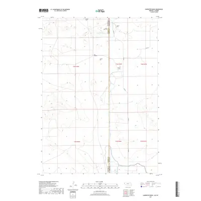
2017 Map of Carpenter Ranch
USGS Topo · Published 2017About this map
The Wyoming-Nebraska state line bisects this landscape, marking a transition between the rangelands of Goshen and Sioux counties. Centered on the Carpenter Ranch, the area is defined by the critical management of water in an arid environment, notably through the Carpenter Reservoir Number 1 and the engineered path of the Interstate Canal. This irrigation infrastructure, including Lateral Number 2, supports the agricultural operations and cattle ranching that have long characterized the High Plains. High points like Indian River Hill, Coyote Hill, and the locally named Hill Windmill provide relief in a terrain otherwise carved by intermittent watercourses like George Draw. A sparse network of rural routes, including Henry Rd and Moore Rd, connects the remote ranching outposts across the high prairie.
Find a feature on this map
19 named features on this map. Tap any name to fly to it.
Don’t see what you’re looking for? This feature index may not catch every label — zoom into the map to look around manually.
Map Details
Editions of this 2017 Carpenter Ranch Map
This is the sole edition of this map. No revisions or reprints were ever made.
Other maps of this area

1896 · Patrick
USGS Topo · 1:125,000

1899 · Whistle Creek
USGS Topo · 1:125,000

1954 · Torrington
USGS Topo · 1:250,000

1955 · Alliance
USGS Topo · 1:250,000

1957 · Alliance
USGS Topo · 1:250,000

1958 · Torrington
USGS Topo · 1:250,000

1958 · Alliance
USGS Topo · 1:250,000

1963 · Chalk Buttes
USGS Topo · 1:24,000
1963 · Torrington SE
USGS Topo · 1:24,000

1963 · Tea Kettle Rock
USGS Topo · 1:24,000