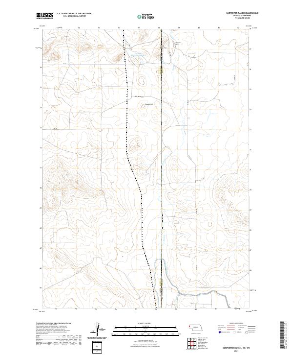
2021 Map of Carpenter Ranch
USGS Topo · Published 2021About this map
Carpenter Ranch serves as a primary marker on this high plains landscape at the border of Nebraska and Wyoming. The terrain is defined by dry drainage features like George Draw and Sheep Cr, while human intervention is visible through the managed water systems of the Interstate Canal and Lateral Number 4. These irrigation works represent the vital infrastructure required for ranching and agriculture in the arid Sioux County region. Prominent elevations such as Indian River Hill and Coyote Hill punctuate the open country, while the presence of the Hill Windmill and Carpenter Reservoir Number 1 indicates the ongoing necessity of groundwater and storage for livestock and land management.
Find a feature on this map
22 named features on this map. Tap any name to fly to it.
Don’t see what you’re looking for? This feature index may not catch every label — zoom into the map to look around manually.
Map Details
Editions of this 2021 Carpenter Ranch Map
This is the sole edition of this map. No revisions or reprints were ever made.
Other maps of this area

1896 · Patrick
USGS Topo · 1:125,000

1899 · Whistle Creek
USGS Topo · 1:125,000

1954 · Torrington
USGS Topo · 1:250,000

1955 · Alliance
USGS Topo · 1:250,000

1957 · Alliance
USGS Topo · 1:250,000

1958 · Torrington
USGS Topo · 1:250,000

1958 · Alliance
USGS Topo · 1:250,000

1963 · Chalk Buttes
USGS Topo · 1:24,000
1963 · Torrington SE
USGS Topo · 1:24,000

1963 · Tea Kettle Rock
USGS Topo · 1:24,000