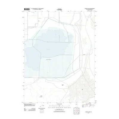
2011 Map of Carson Lake
USGS Topo · Published 2011About this map
Carson Lake and its surrounding wetlands dominate this Churchill County landscape, reflecting the intricate water management required in the high desert of Nevada. The hydrography is defined by engineered features such as East Lee Drain and West Lee Drain, which channel water across the basin toward the Carson Lake Pasture. To the south, the terrain shifts dramatically from the level expanse of Bass Flat to the rising elevations of the White Throne Mountains, marked by the distinct topographical break of the Wildcat Scarp. The presence of Home Corral and Southeast Corral suggests the continued importance of livestock and range management in this arid region, while the local road network, including Beach Rd and Pasture Rd, provides access to the shoreline and grazing lands.
Find a feature on this map
15 named features on this map. Tap any name to fly to it.
Don’t see what you’re looking for? This feature index may not catch every label — zoom into the map to look around manually.
Map Details
Editions of this 2011 Carson Lake Map
This is the sole edition of this map. No revisions or reprints were ever made.
Other maps of this area

1908 · Carson Sink
USGS Topo · 1:250,000

1910 · Carson Sink
USGS Topo · 1:250,000

1951 · Carson Lake
USGS Topo · 1:62,500

1951 · Allen Springs
USGS Topo · 1:62,500

1951 · Weber Reservoir
USGS Topo · 1:62,500

1951 · Fallon
USGS Topo · 1:62,500

1957 · Reno
USGS Topo · 1:250,000

1959 · Reno
USGS Topo · 1:250,000

1960 · Reno
USGS Topo · 1:250,000

1979 · Fallon
USGS Topo · 1:100,000