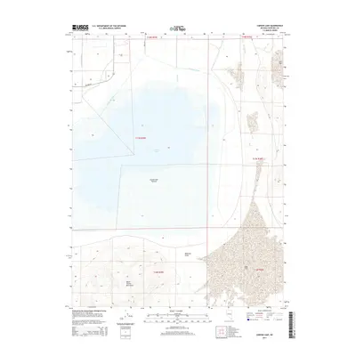
2014 Map of Carson Lake
USGS Topo · Published 2014About this map
Carson Lake and its surrounding wetlands define this Churchill County landscape, where complex irrigation and drainage networks support the high desert ecosystem. The map reveals an engineered water system including the Rice Ditch, East Lee Drain, and Pierson Slough, which feed into and manage the namesake water body. These features speak to the long history of water management in the Lahontan Valley, illustrating how drainage from upstream agricultural projects is directed toward the Carson Lake Pasture.
Find a feature on this map
22 named features on this map. Tap any name to fly to it.
Don’t see what you’re looking for? This feature index may not catch every label — zoom into the map to look around manually.
Map Details
Editions of this 2014 Carson Lake Map
This is the sole edition of this map. No revisions or reprints were ever made.
Other maps of this area

1908 · Carson Sink
USGS Topo · 1:250,000

1910 · Carson Sink
USGS Topo · 1:250,000

1951 · Carson Lake
USGS Topo · 1:62,500

1951 · Allen Springs
USGS Topo · 1:62,500

1951 · Weber Reservoir
USGS Topo · 1:62,500

1951 · Fallon
USGS Topo · 1:62,500

1957 · Reno
USGS Topo · 1:250,000

1959 · Reno
USGS Topo · 1:250,000

1960 · Reno
USGS Topo · 1:250,000

1979 · Fallon
USGS Topo · 1:100,000