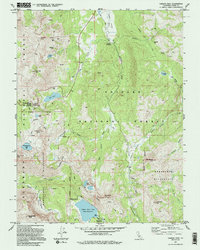
1992 Map of Carson Pass
USGS Topo · Published 1994About this map
Carson Pass serves as the central focal point of this high-altitude landscape, where the Snowshoe Thompson & Kit Carson (Historical Monuments) commemorate the early pioneers who traversed this Sierra Nevada crossing. The map reveals a legacy of resource extraction through several documented sites, including the Alpine Mine, Alhambra Mine, and Burnside Mine scattered near the peaks. High mountain water management is evident at the Upper Blue Lake and its Boat Ramp, alongside the natural basins of Red Lake and Winnemucca Lake. This 1990s revision details a vast recreational network where the Pacific Crest National Scenic Trail winds through the Mokelumne Wilderness. The drainage patterns of the West Fork Carson River connect the expansive grazing and meadow lands of Hope Valley and Faith Valley.
Find a feature on this map
51 named features on this map. Tap any name to fly to it.
Don’t see what you’re looking for? This feature index may not catch every label — zoom into the map to look around manually.
Map Details
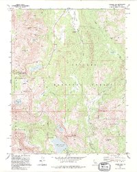
Editions of this 1992 Carson Pass Map
2 editions found
Other maps of this area

1889 · Pyramid Peak
USGS Topo · 1:125,000

1889 · Markleeville
USGS Topo · 1:125,000

1891 · Markleeville
USGS Topo · 1:125,000

1891 · Pyramid Peak
USGS Topo · 1:125,000

1893 · Markleeville
USGS Topo · 1:125,000

1895 · Pyramid Peak
USGS Topo · 1:125,000

1896 · Pyramid Peak
USGS Topo · 1:125,000

1947 · Sacramento
USGS Topo · 1:250,000

1948 · Walker Lake
USGS Topo · 1:250,000

1948 · Sacramento
USGS Topo · 1:250,000