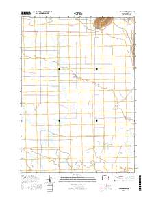
2017 Map of Carson Point
USGS Topo · Published 2017About this map
Carson Point rises above a high-desert landscape defined by intricate water management and seasonal basins in this Harney County study. The terrain is a network of sinks and sloughs, where the Poujade Ditch and natural watercourses like Rock Cr and Little Rock Cr negotiate the arid environment. Large basins such as Bennett Lake and Howell Lake sit among a grid of rural lanes, illustrating the remote ranching infrastructure of eastern Oregon. A system of named local roads, including Crane-Buchanan Rd and Newton Rd, connects these isolated water features. The presence of the Cow Creek Sink near Cow Creek Rd highlights the unique drainage patterns of the region, where water often gathers in interior depressions rather than flowing to the sea.
Find a feature on this map
30 named features on this map. Tap any name to fly to it.
Don’t see what you’re looking for? This feature index may not catch every label — zoom into the map to look around manually.
Map Details
Editions of this 2017 Carson Point Map
This is the sole edition of this map. No revisions or reprints were ever made.
Other maps of this area

1955 · Burns
USGS Topo · 1:250,000

1958 · Burns
USGS Topo · 1:250,000

1959 · Burns
USGS Topo · 1:250,000

1959 · Harney
USGS Topo · 1:62,500

1959 · Lawen
USGS Topo · 1:62,500

1960 · Crane
USGS Topo · 1:62,500

1973 · Buchanan
USGS Topo · 1:24,000

1973 · Mahon Creek
USGS Topo · 1:24,000

1973 · Carson Point
USGS Topo · 1:24,000
1978 · Stinkingwater Pass
USGS Topo · 1:24,000