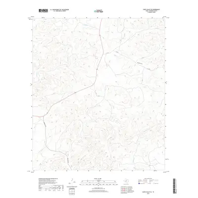
2019 Map of Carta Valley SE
USGS Topo · Published 2019About this map
Sycamore Cr and Red Bluff Cr carve through this section of the Edwards Plateau, illustrating the dendritic drainage patterns typical of the southwest Texas hill country. The landscape is defined by its seasonal watercourses, including the prominent Fivemile Draw, which shape the local ranching environment. Ranchers and land managers in this era relied on a sparse but critical network of thoroughfares such as Ranch Rd 2523 and Cr 470 to navigate the undulating terrain. This 2019 data from the U.S. Geological Survey reflects the modern infrastructure of Edwards County, where county roads like Co Rd 302 and Co Rd 22 provide access to remote acreage and private land holdings. The map serves as a contemporary record of how transportation and natural hydrology intersect in a region where water remains the most significant geographical influencer.
Find a feature on this map
8 named features on this map. Tap any name to fly to it.
Don’t see what you’re looking for? This feature index may not catch every label — zoom into the map to look around manually.
Map Details
Editions of this 2019 Carta Valley SE Map
This is the sole edition of this map. No revisions or reprints were ever made.
Other maps of this area

1893 · Nueces
USGS Topo · 1:125,000

1896 · Nueces
USGS Topo · 1:125,000

1943 · Carta Valley
USGS Topo · 1:62,500

1944 · Flat Rock
USGS Topo · 1:62,500

1944 · Indian Creek
USGS Topo · 1:62,500

1944 · Indian Mountain
USGS Topo · 1:62,500

1958 · Del Rio
USGS Topo · 1:250,000

1964 · Del Rio
USGS Topo · 1:250,000
1971 · Carta Valley NE
USGS Topo · 1:24,000
1971 · Black Waterhole
USGS Topo · 1:24,000