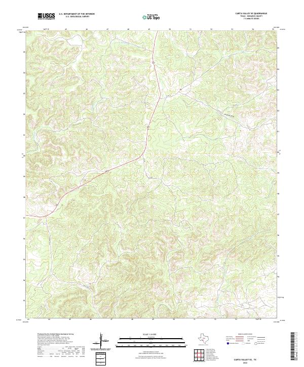
2022 Map of Carta Valley SE
USGS Topo · Published 2022About this map
Sycamore Creek and Red Bluff Creek carve deep drainage patterns through this southwestern Texas landscape, defining a network of draws and arroyos typical of the Edwards Plateau. The terrain is marked by significant elevation changes, with ridges and valleys dictating the winding paths of rural infrastructure. Transportation through this remote section of Edwards County is anchored by the diagonal transit of Highway 377, which intersects with several local routes including County Road 22 and Ranch Road 2523. The survey captures the distribution of water resources such as Fivemile Draw, which are critical indicators of local topography in this arid environment. This map serves as a detailed record of modern land use and drainage in an area defined more by its natural watercourses and ranch access roads than by dense settlement.
Find a feature on this map
9 named features on this map. Tap any name to fly to it.
Don’t see what you’re looking for? This feature index may not catch every label — zoom into the map to look around manually.
Map Details
Editions of this 2022 Carta Valley SE Map
This is the sole edition of this map. No revisions or reprints were ever made.
Other maps of this area

1893 · Nueces
USGS Topo · 1:125,000

1896 · Nueces
USGS Topo · 1:125,000

1943 · Carta Valley
USGS Topo · 1:62,500

1944 · Flat Rock
USGS Topo · 1:62,500

1944 · Indian Creek
USGS Topo · 1:62,500

1944 · Indian Mountain
USGS Topo · 1:62,500

1958 · Del Rio
USGS Topo · 1:250,000

1964 · Del Rio
USGS Topo · 1:250,000
1971 · Carta Valley NE
USGS Topo · 1:24,000
1971 · Black Waterhole
USGS Topo · 1:24,000