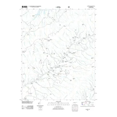
2011 Map of Carter
USGS Topo · Published 2011About this map
Holston Mountain dominates this Carter County landscape, anchoring a complex network of ridges and hollows defined by the region's legacy of timber and mineral extraction. Small mountain communities like Buladeen, Sadie, and Carter are linked by winding roads that trace the watercourses of Stony Creek and its many branches. The land is punctuated by evidence of early industrial activity, particularly mining and quarrying. Numerous named operations, such as the Taylor Ridge Mine and the Helenmode Pyrite Mine, follow the mineral seams along the steep slopes of Taylor Ridge. The social fabric of these rural settlements is marked by family-named landmarks and local burial grounds, including Buckles Cemetery, Ritchie Cemetery, and Marklin Cemetery. From the higher elevations at Holston High Knob down to the shores of South Holston Lake, the map documents a terrain where geology and genealogy are deeply intertwined.
Find a feature on this map
162 named features on this map. Tap any name to fly to it.
Don’t see what you’re looking for? This feature index may not catch every label — zoom into the map to look around manually.
Map Details
Editions of this 2011 Carter Map
This is the sole edition of this map. No revisions or reprints were ever made.
Other maps of this area

1891 · Roan Mountain
USGS Topo · 1:125,000

1891 · Abingdon
USGS Topo · 1:125,000

1893 · Cranberry
USGS Topo · 1:125,000

1894 · Roan Mountain
USGS Topo · 1:125,000

1894 · Abingdon
USGS Topo · 1:125,000

1895 · Cranberry
USGS Topo · 1:125,000

1897 · Bristol
USGS Topo · 1:125,000

1899 · Cranberry
USGS Topo · 1:125,000

1902 · Bristol
USGS Topo · 1:125,000

1902 · Cranberry
USGS Topo · 1:125,000