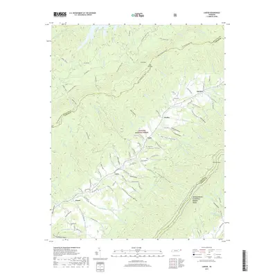
2019 Map of Carter
USGS Topo · Published 2019About this map
Buladeen and the high ridges of the Cherokee National Forest define this corner of Northeast Tennessee, where the landscape is marked by deep hollows and steep mountain trails. Family history is etched into the terrain through numerous burial grounds like Marklin Cem, Grindstaff Cem, and Buckles Cem, serving as anchors for the small settlements of Sadie and Carter. The geography is shaped by the transition from the shores of South Holston Lake in the northwest to the high elevations of the Appalachian National Scenic Trail as it winds across the eastern ridges. Along Stony Creek, a network of local roads such as Hardin Hollow Road and Blevins Hollow Road connects isolated valley homesites. The map illustrates a complex drainage system where dozens of named branches, including George Branch and Carter Branch, feed into the primary creek systems.
Find a feature on this map
138 named features on this map. Tap any name to fly to it.
Don’t see what you’re looking for? This feature index may not catch every label — zoom into the map to look around manually.
Map Details
Editions of this 2019 Carter Map
This is the sole edition of this map. No revisions or reprints were ever made.
Other maps of this area

1891 · Roan Mountain
USGS Topo · 1:125,000

1891 · Abingdon
USGS Topo · 1:125,000

1893 · Cranberry
USGS Topo · 1:125,000

1894 · Roan Mountain
USGS Topo · 1:125,000

1894 · Abingdon
USGS Topo · 1:125,000

1895 · Cranberry
USGS Topo · 1:125,000

1897 · Bristol
USGS Topo · 1:125,000

1899 · Cranberry
USGS Topo · 1:125,000

1902 · Bristol
USGS Topo · 1:125,000

1902 · Cranberry
USGS Topo · 1:125,000