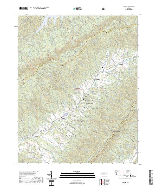
2022 Map of Carter
USGS Topo · Published 2022About this map
Holston Mtn and its prominent Holston High Knob anchor this landscape along the border of Sullivan and Carter Counties. The high ridges of the Cherokee National Forest are traversed by the Appalachian National Scenic Trail, which winds through Turkeypen Gap and over Peters Ridge. Settlement is concentrated in the valley floors along Stony Cr, where the communities of Carter, Winner, and Buladeen are situated. Family history is etched into the terrain through numerous small burial sites such as Grindstaff Cem, Buckles Cem, and Ritchie Cem, as well as the naming of hollows like Hardin Hollow and Blevins Hollow. The transition from the steep elevations of Huckleberry Ridge to the lower homesteads along Dry Hollow Rd illustrates the historical reliance on narrow valley corridors for travel and habitation in this corner of Northeast Tennessee.
Find a feature on this map
165 named features on this map. Tap any name to fly to it.
Don’t see what you’re looking for? This feature index may not catch every label — zoom into the map to look around manually.
Map Details
Editions of this 2022 Carter Map
This is the sole edition of this map. No revisions or reprints were ever made.
Other maps of this area

1891 · Roan Mountain
USGS Topo · 1:125,000

1891 · Abingdon
USGS Topo · 1:125,000

1893 · Cranberry
USGS Topo · 1:125,000

1894 · Roan Mountain
USGS Topo · 1:125,000

1894 · Abingdon
USGS Topo · 1:125,000

1895 · Cranberry
USGS Topo · 1:125,000

1897 · Bristol
USGS Topo · 1:125,000

1899 · Cranberry
USGS Topo · 1:125,000

1902 · Bristol
USGS Topo · 1:125,000

1902 · Cranberry
USGS Topo · 1:125,000