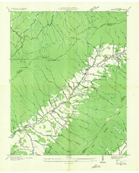
1935 Map of Carter
USGS Topo · Published 1935About this map
Stony Creek flows through a deep valley between Holston Mountain and Iron Mountain in this 1935 survey. The settlement pattern follows the narrow valley floor, where small communities like Buladeen, Sadie, and Winner are linked by State Highway No 91. The industrial character of the era is evident through numerous resource extraction sites, including the Stoutson Quarry, the Hodge Ore Bank, and several Lime Kiln operations. Educational and religious life for these rural families centered on local landmarks such as Unaka Sch, Caldwell Springs Sch, and Holly Springs Ch. The surrounding slopes within the Unaka National Forest are marked by a network of footpaths like the West Morrill Trail, while the Stony Creek Fire Tower stands watch over the timbered ridges.
Find a feature on this map
83 named features on this map. Tap any name to fly to it.
Don’t see what you’re looking for? This feature index may not catch every label — zoom into the map to look around manually.
Map Details
Editions of this 1935 Carter Map
This is the sole edition of this map. No revisions or reprints were ever made.
Other maps of this area

1891 · Roan Mountain
USGS Topo · 1:125,000

1891 · Abingdon
USGS Topo · 1:125,000

1893 · Cranberry
USGS Topo · 1:125,000

1894 · Roan Mountain
USGS Topo · 1:125,000

1894 · Abingdon
USGS Topo · 1:125,000

1895 · Cranberry
USGS Topo · 1:125,000

1897 · Bristol
USGS Topo · 1:125,000

1899 · Cranberry
USGS Topo · 1:125,000

1902 · Bristol
USGS Topo · 1:125,000

1902 · Cranberry
USGS Topo · 1:125,000