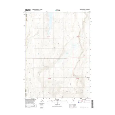
2015 Map of Carter Reservoir
USGS Topo · Published 2015About this map
The Applegate Trl cuts through this high desert terrain, marking a historic corridor of western migration across the border of Modoc and Washoe Counties. This arid landscape is defined by its critical water sources, including the expansive New Year Lake to the north and Carter Reservoir near the center. The presence of numerous watering points like Big Spring, Juniper Spring, and Willow Springs illustrates the vital infrastructure required for travel and ranching in this portion of the Great Basin. To the southeast, the topography rises toward Metzker Peak, overlooking the broad expanse of Long Valley. The map also delineates the precise boundary between California and Nevada, showing how the state line bisects these remote volcanic plateaus and seasonal basins such as Mud Lake.
Find a feature on this map
17 named features on this map. Tap any name to fly to it.
Don’t see what you’re looking for? This feature index may not catch every label — zoom into the map to look around manually.
Map Details
Editions of this 2015 Carter Reservoir Map
This is the sole edition of this map. No revisions or reprints were ever made.
Other maps of this area

1886 · Alturas
USGS Topo · 1:250,000

1889 · Long Valley
USGS Topo · 1:250,000

1892 · Alturas
USGS Topo · 1:250,000

1954 · Vya
USGS Topo · 1:250,000

1954 · Alturas
USGS Topo · 1:250,000

1958 · Alturas
USGS Topo · 1:250,000

1958 · Vya
USGS Topo · 1:250,000

1962 · Alturas
USGS Topo · 1:250,000

1962 · Vya
USGS Topo · 1:250,000

1962 · Cedarville
USGS Topo · 1:62,500