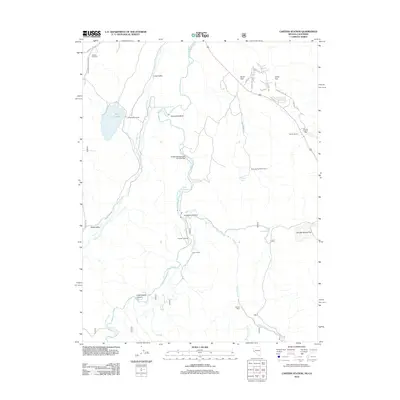
2012 Map of Carters Station
USGS Topo · Published 2012About this map
East Fork Carson River carves a winding path through this corner of the Nevada-California border, defining a landscape of high valleys and canyons. The map documents the persistent agricultural and industrial presence in the region, from the Indian Valley Ranch to the Nevada Tungsten Mill near Carters Station. Movement through the terrain is marked by historic crossings and water management features, including Youngs Crossing, the Uhalde Springmeyer Stock Bridge, and the Falke and Tillman Ditch.
Find a feature on this map
39 named features on this map. Tap any name to fly to it.
Don’t see what you’re looking for? This feature index may not catch every label — zoom into the map to look around manually.
Map Details
Editions of this 2012 Carters Station Map
This is the sole edition of this map. No revisions or reprints were ever made.
Other maps of this area

1889 · Markleeville
USGS Topo · 1:125,000

1891 · Markleeville
USGS Topo · 1:125,000

1893 · Markleeville
USGS Topo · 1:125,000

1948 · Walker Lake
USGS Topo · 1:250,000

1956 · Freel Peak
USGS Topo · 1:62,500

1956 · Topaz Lake
USGS Topo · 1:62,500

1956 · Markleeville
USGS Topo · 1:62,500

1957 · Walker Lake
USGS Topo · 1:250,000
1957 · Mt. Siegel
USGS Topo · 1:62,500

1962 · Walker Lake
USGS Topo · 1:250,000