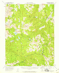
1956 Map of Markleeville
USGS Topo · Published 1959About this map
Markleeville serves as the central hub of this High Sierra landscape, situated near the confluence of the East Fork Carson River and Hot Springs Creek. The survey reveals a region defined by its mid-century mineral and recreation interests, where the Silver Mtn (Site) and numerous historic workings like the Burnside Mine, Alhambra Mine, and IXL Mine dot the alpine terrain. Access to the high country is marked by a network of jeep trails and significant mountain crossings, most notably the high-elevation Ebbetts Pass and the Pacific Grade Summit.
Find a feature on this map
112 named features on this map. Tap any name to fly to it.
Don’t see what you’re looking for? This feature index may not catch every label — zoom into the map to look around manually.
Map Details
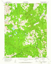
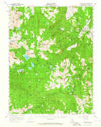
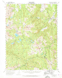
Editions of this 1956 Markleeville Map
4 editions found
Other maps of this area

1889 · Pyramid Peak
USGS Topo · 1:125,000

1889 · Markleeville
USGS Topo · 1:125,000

1891 · Markleeville
USGS Topo · 1:125,000

1891 · Big Trees
USGS Topo · 1:125,000

1891 · Pyramid Peak
USGS Topo · 1:125,000

1893 · Markleeville
USGS Topo · 1:125,000

1894 · Big Trees
USGS Topo · 1:125,000

1895 · Pyramid Peak
USGS Topo · 1:125,000

1896 · Dardanelles
USGS Topo · 1:125,000

1896 · Pyramid Peak
USGS Topo · 1:125,000