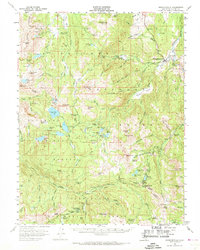
1956 Map of Markleeville
USGS Topo · Published 1969About this map
Markleeville serves as the focal point for this high-altitude survey of Alpine County, situated where the West Fork Carson River and East Fork Carson River traverse a landscape defined by the crest of the Carson Range. The mid-1950s data reveals a region deeply tied to its extraction and transit history, featuring numerous legacy mining operations such as the Alhambra Mine, Cal Pine Mine, and the IXL Mine. Significant mountain thoroughfares including Carson Pass and Ebbetts Pass are documented, alongside the historic Silver Mtn (Site). The map details a network of canyons and meadows, from Millberry Canyon to Milk Ranch Meadow, which supported both early industry and the mid-century expansion of recreational sites like the Hope Valley Campground and Stevenot Camp. Land management is divided across several jurisdictions, including the Toiyabe National Forest and Eldorado National Forest, illustrating the remote character of this Sierra Nevada enclave.
Find a feature on this map
132 named features on this map. Tap any name to fly to it.
Don’t see what you’re looking for? This feature index may not catch every label — zoom into the map to look around manually.
Map Details
Editions of this 1956 Markleeville Map
4 editions found

Other maps of this area

1889 · Pyramid Peak
USGS Topo · 1:125,000

1889 · Markleeville
USGS Topo · 1:125,000

1891 · Markleeville
USGS Topo · 1:125,000

1891 · Big Trees
USGS Topo · 1:125,000

1891 · Pyramid Peak
USGS Topo · 1:125,000

1893 · Markleeville
USGS Topo · 1:125,000

1894 · Big Trees
USGS Topo · 1:125,000

1895 · Pyramid Peak
USGS Topo · 1:125,000

1896 · Dardanelles
USGS Topo · 1:125,000

1896 · Pyramid Peak
USGS Topo · 1:125,000