1956 Map of Markleeville
USGS Topo · Published 1961About this map
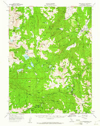
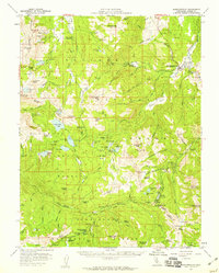
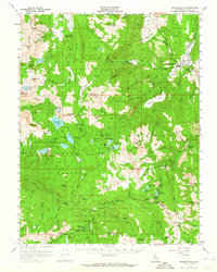
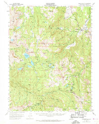
Markleeville serves as the hub of this high-altitude landscape in the mid-1950s, situated at the confluence of several mountain creeks. The map documents a geography defined by the extraction of minerals and the seasonal movement of travelers, featuring several named mining operations such as the Alpine Mine, Alhambra Mine, and IXL Mine. A significant historical footprint is visible at Silver Mtn (Site), indicating the transient nature of mountain settlements during the region's mining booms.
Find a feature on this map
126 named features on this map. Tap any name to fly to it.
Don’t see what you’re looking for? This feature index may not catch every label — zoom into the map to look around manually.
Map Details
Editions of this 1956 Markleeville Map
4 editions found
Other maps of this area

1889 · Pyramid Peak
USGS Topo · 1:125,000

1889 · Markleeville
USGS Topo · 1:125,000

1891 · Markleeville
USGS Topo · 1:125,000

1891 · Big Trees
USGS Topo · 1:125,000

1891 · Pyramid Peak
USGS Topo · 1:125,000

1893 · Markleeville
USGS Topo · 1:125,000

1894 · Big Trees
USGS Topo · 1:125,000

1895 · Pyramid Peak
USGS Topo · 1:125,000

1896 · Dardanelles
USGS Topo · 1:125,000

1896 · Pyramid Peak
USGS Topo · 1:125,000