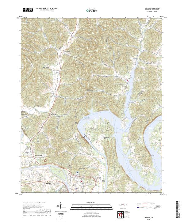
2022 Map of Carthage
USGS Topo · Published 2022About this map
The Cumberland River carves a dramatic path through Smith County, shaping the landscape near Carthage and its neighboring communities. This 2022 survey captures the modern topography around the Cordell Hull Reservoir, where the river winds through significant bends such as McClures Bend and Horseshoe Bend. The terrain is characterized by a dense network of hollows, including Tony Hollow and Friendship Hollow, which speak to the complex drainage system feeding into the main river channel. The map highlights the layout of local infrastructure, from the Smith County Court Facility to the distinct residential clusters of South Carthage and Tanglewood. Local history is preserved in naming conventions throughout the hills, where the Dukes Cem and landmarks like Petty Bluff and Tater Knob provide anchor points for genealogical research and geographic study in this part of Middle Tennessee.
Find a feature on this map
117 named features on this map. Tap any name to fly to it.
Don’t see what you’re looking for? This feature index may not catch every label — zoom into the map to look around manually.
Map Details
Editions of this 2022 Carthage Map
This is the sole edition of this map. No revisions or reprints were ever made.