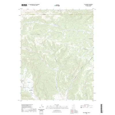
2023 Map of Casa Grande
USGS Topo · Published 2023About this map
Casa Grande sits in the lower western portion of this high-altitude landscape where the Sangre de Cristo foothills descend toward the high plains. The topography is dominated by a complex network of drainages including Canadian River, Patton Creek, and York Canyon, which carve deep paths through the timbered terrain. This modern survey reflects the enduring character of this borderland, where the Las Animas Co line in Colorado meets the New Mexican territory of Colfax Co. The map illustrates the specialized infrastructure of the region, specifically near the Vermejo Park area, where roads like the Vermejo Rd and School House Rd provide access through the secluded flats and canyons.
Find a feature on this map
1 named feature on this map. Tap any name to fly to it.
Don’t see what you’re looking for? This feature index may not catch every label — zoom into the map to look around manually.
Map Details
Editions of this 2023 Casa Grande Map
This is the sole edition of this map. No revisions or reprints were ever made.
Other maps of this area

1891 · Spanish Peaks
USGS Topo · 1:125,000

1893 · Spanish Peaks
USGS Topo · 1:125,000

1895 · Spanish Peaks
USGS Topo · 1:125,000

1897 · Spanish Peaks
USGS Topo · 1:125,000

1900 · Spanish Peaks
USGS Topo · 1:125,000

1954 · Raton
USGS Topo · 1:250,000

1954 · Trinidad
USGS Topo · 1:250,000

1955 · Trinidad
USGS Topo · 1:250,000

1958 · Raton
USGS Topo · 1:250,000

1958 · Trinidad
USGS Topo · 1:250,000