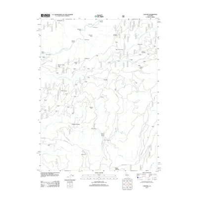
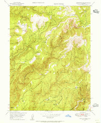
2012 Map of Cascade
USGS Topo · Published 2012About this map
Nelsons Crossing serves as a central point in this landscape of the northern Sierra Nevada, where the Fall River meets a network of primitive roads and mountain ridges. The terrain is defined by the deep incisions of the Middle Fork Feather River and its various branches, creating a series of prominent high points like Kenebeck Ridge and Lava Top. The map reflects a history of small-scale settlement and seasonal habitation, evidenced by numerous named cabins and homesteads such as Granes Cabin, Bills Cabin, and the Jackson Ranch. This 2012 survey illustrates the modern intersection of recreation and utility, with the Fall River Campground and Camp Eighteen located near water sources, while the complex system of forest roads, including La Porte Rd and Lumpkin Ridge Rd, provides access to remote river bars like Hansons Bar and Morgan Bar.
Find a feature on this map
54 named features on this map. Tap any name to fly to it.
Don’t see what you’re looking for? This feature index may not catch every label — zoom into the map to look around manually.
Map Details
Editions of this 2012 Cascade Map
This is the sole edition of this map. No revisions or reprints were ever made.
Other maps of this area

1888 · Bidwell Bar
USGS Topo · 1:125,000

1891 · Bidwell Bar
USGS Topo · 1:125,000

1893 · Bidwell Bar
USGS Topo · 1:125,000

1895 · Bidwell Bar
USGS Topo · 1:125,000

1897 · Bidwell Bar
USGS Topo · 1:125,000
1947 · Brush Creek
USGS Topo · 1:24,000

1948 · Big Bend Mtn
USGS Topo · 1:62,500
1948 · Mooreville Ridge
USGS Topo · 1:62,500
1948 · Cascade
USGS Topo · 1:24,000
1948 · American House
USGS Topo · 1:24,000