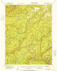
1948 Map of Mooreville Ridge
USGS Topo · Published 1953About this map
The Middle Fork Feather River and its south fork dominate this Sierra Nevada landscape, where the 1948 terrain reveals a history of timber and gold extraction. From the northern peaks of Mooreville Ridge down to the deep cuts of Devil Canyon, the area is punctuated by remote mountain cabins like Kennedy Cabin and Graves Cabin. The map details the transition between Plumas National Forest and Tahoe National Forest, showing a network of logging camps and settlements such as Clipper Mills and Strawberry Valley.
Find a feature on this map
127 named features on this map. Tap any name to fly to it.
Don’t see what you’re looking for? This feature index may not catch every label — zoom into the map to look around manually.
Map Details
Editions of this 1948 Mooreville Ridge Map
3 editions found
Other maps of this area

1888 · Smartsville
USGS Topo · 1:125,000

1888 · Bidwell Bar
USGS Topo · 1:125,000

1891 · Bidwell Bar
USGS Topo · 1:125,000

1891 · Downieville
USGS Topo · 1:125,000

1891 · Colfax
USGS Topo · 1:125,000

1891 · Smartsville
USGS Topo · 1:125,000

1892 · Smartsville
USGS Topo · 1:125,000

1892 · Colfax
USGS Topo · 1:125,000

1893 · Bidwell Bar
USGS Topo · 1:125,000

1893 · Downieville
USGS Topo · 1:125,000