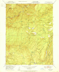
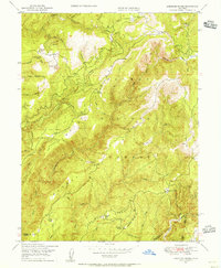
1950 Map of Cascade
USGS Topo · Published 1950About this map
The Middle Fork Feather River carves through this high-country landscape on the border of Butte and Plumas counties. Post-war industrial activity is evident in the presence of a Logging RR following the curves of Pumpkin Creek and Fall River in the south, while the Walters Mine sits on the eastern slopes of Hartman Ridge. The map documents a sparsely populated region defined by remote homesteads and operational sites such as Graves Cabin, Kennedy Cabin, and the Mountain Spring House. Local transport and recreation are marked by the Hansans Bar Trail leading toward the river and the Fall River Campground. Small, named settlements like Cascade and the Jackson Ranch provide a look at the mid-century footprint of these mountain communities before modern development shifted the character of the Plumas National Forest.
Find a feature on this map
63 named features on this map. Tap any name to fly to it.
Don’t see what you’re looking for? This feature index may not catch every label — zoom into the map to look around manually.
Map Details
Editions of this 1950 Cascade Map
This is the sole edition of this map. No revisions or reprints were ever made.
Other maps of this area

1888 · Bidwell Bar
USGS Topo · 1:125,000

1891 · Bidwell Bar
USGS Topo · 1:125,000

1893 · Bidwell Bar
USGS Topo · 1:125,000

1895 · Bidwell Bar
USGS Topo · 1:125,000

1897 · Bidwell Bar
USGS Topo · 1:125,000
1947 · Brush Creek
USGS Topo · 1:24,000

1948 · Big Bend Mtn
USGS Topo · 1:62,500
1948 · Mooreville Ridge
USGS Topo · 1:62,500
1948 · Cascade
USGS Topo · 1:24,000
1948 · American House
USGS Topo · 1:24,000