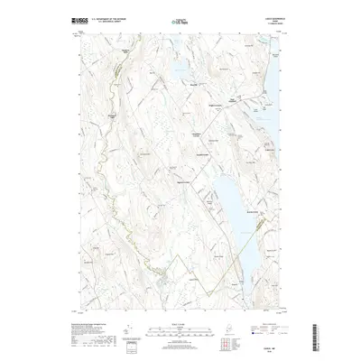
2018 Map of Casco
USGS Topo · Published 2018About this map
Bolsters Mills and Scribners Mill anchor this part of the Maine interior, where the Crooked River snakes through a landscape defined by its glacial history and water-powered industry. The transition between Cumberland and Oxford counties is marked by a network of small settlements like Spurrs Corner, East Otisfield, and Rayville. The map reveals a high concentration of historical burial sites, including the Highland Cem, Bell Hill Cem, and the Scribner Hill Upper Yard, providing a clear record of local family lineages and early townships. Low-lying wetlands such as College Swamp and Long Meadows contrast with the higher elevations of Big Hill and Scribner Hill, while large water bodies like Thompson Lake and Pleasant Lake dominate the eastern reaches. This modern survey maps the enduring rural character of the region, from the Jugtown Plain to the small village of Casco.
Find a feature on this map
174 named features on this map. Tap any name to fly to it.
Don’t see what you’re looking for? This feature index may not catch every label — zoom into the map to look around manually.
Map Details
Editions of this 2018 Casco Map
This is the sole edition of this map. No revisions or reprints were ever made.
Other maps of this area

1894 · Gray
USGS Topo · 1:62,500

1896 · Norway
USGS Topo · 1:62,500

1896 · Sebago
USGS Topo · 1:62,500

1898 · Gray
USGS Topo · 1:62,500

1908 · Poland
USGS Topo · 1:62,500

1940 · Poland
USGS Topo · 1:62,500

1942 · Poland
USGS Topo · 1:62,500

1942 · Gray
USGS Topo · 1:62,500

1942 · Sebago Lake
USGS Topo · 1:62,500

1943 · Sebago Lake
USGS Topo · 1:62,500