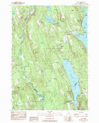
1983 Map of Casco
USGS Topo · Published 1984About this map
Crooked River meanders through the heart of this landscape, defining the border between Harrison and Otisfield. The area is characterized by its prominent lake systems, with Pleasant Lake and Thompson Lake anchoring the eastern side, while smaller bodies like Saturday Pond and Moose Pond dot the northern hills. This 1980s-era survey reveals a community deeply tied to its geography, where hamlets such as Bolsters Mills and Scribners Mill reflect an early industrial heritage built along the waterways.
Find a feature on this map
83 named features on this map. Tap any name to fly to it.
Don’t see what you’re looking for? This feature index may not catch every label — zoom into the map to look around manually.
Map Details
Editions of this 1983 Casco Map
This is the sole edition of this map. No revisions or reprints were ever made.
Other maps of this area

1894 · Gray
USGS Topo · 1:62,500

1896 · Norway
USGS Topo · 1:62,500

1896 · Sebago
USGS Topo · 1:62,500

1898 · Gray
USGS Topo · 1:62,500

1908 · Poland
USGS Topo · 1:62,500

1940 · Poland
USGS Topo · 1:62,500

1942 · Poland
USGS Topo · 1:62,500

1942 · Gray
USGS Topo · 1:62,500

1942 · Sebago Lake
USGS Topo · 1:62,500

1943 · Sebago Lake
USGS Topo · 1:62,500