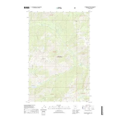
2020 Map of Cashmere Mountain
USGS Topo · Published 2020About this map
Wenatchee National Forest encompasses this high-elevation landscape, where the granite peaks of the Cascades create a complex drainage system within Chelan County. Dominating the central terrain, Cashmere Mtn serves as a hub for numerous seasonal flows including Victoria Creek and Doctor Creek. The map documents a dense concentration of alpine water bodies, from the larger Stuart Lake and Eightmile Lake to smaller, isolated basins like Coney Lake and Mesa Lake located near the southern boundary. Steep ridgelines such as Icicle Ridge define the northern sector, framing the path of Icicle Creek. This 2020 survey captures the wilderness character of the region, detailing the network of creeks like Mountaineer Creek and Jack Creek that carve through the high-country topography between Cannon Mtn and Edward Peak.
Find a feature on this map
42 named features on this map. Tap any name to fly to it.
Don’t see what you’re looking for? This feature index may not catch every label — zoom into the map to look around manually.
Map Details
Editions of this 2020 Cashmere Mountain Map
This is the sole edition of this map. No revisions or reprints were ever made.
Other maps of this area

1897 · Mount Stuart
USGS Topo · 1:125,000

1901 · Chiwaukum
USGS Topo · 1:125,000

1902 · Mount Stuart
USGS Topo · 1:125,000

1904 · Chiwaukum
USGS Topo · 1:125,000

1957 · Wenatchee
USGS Topo · 1:250,000

1961 · Liberty
USGS Topo · 1:62,500

1961 · Mount Stuart
USGS Topo · 1:62,500

1964 · Leavenworth
USGS Topo · 1:62,500

1965 · Chiwaukum Mts
USGS Topo · 1:62,500

1975 · Wenatchee
USGS Topo · 1:100,000