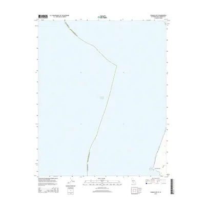
2015 Map of Casmalia OE W
USGS Topo · Published 2015About this map
Purisima Point stands as a prominent coastal feature on the shoreline of Santa Barbara County in this maritime-focused 2015 study. Dominating the western expanse is the Pacific Ocean, which defines the primary environment of this quadrangle. The map captures the rugged coastal boundary where the land meets the sea at this specific geographic point, providing clear documentation of the contemporary shoreline and the immediate coastal topography. While largely oceanic, the land portion near the point offers a detailed record of the terrain and local road paths as they existed in the early 21st century.
Find a feature on this map
3 named features on this map. Tap any name to fly to it.
Don’t see what you’re looking for? This feature index may not catch every label — zoom into the map to look around manually.
Map Details
Editions of this 2015 Casmalia OE W Map
This is the sole edition of this map. No revisions or reprints were ever made.
Other maps of this area

1905 · Guadalupe
USGS Topo · 1:125,000

1942 · Point Arguello
USGS Topo · 1:62,500

1942 · Guadalupe
USGS Topo · 1:125,000

1942 · Point Sal
USGS Topo · 1:62,500
1947 · Casmalia
USGS Topo · 1:24,000
1947 · Guadalupe
USGS Topo · 1:24,000

1947 · Surf
USGS Topo · 1:24,000
1947 · Point Arguello
USGS Topo · 1:62,500
1947 · Point Sal
USGS Topo · 1:62,500
1948 · Point Sal
USGS Topo · 1:24,000