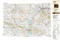
1962 Map of Casper
USGS Topo · Published 1962About this map
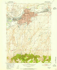
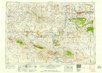
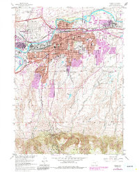
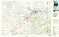
Casper serves as the industrial and transport hub of central Wyoming in this early 1960s representation, where the North Platte River winds through a landscape defined by massive water reclamation and energy extraction. The map reveals a complex network of oil fields, including the Lost Soldier Oil Field and Poison Spider Oil Field, which speak to the region's mid-century economic foundation. Large-scale infrastructure projects are evident in the sprawling Pathfinder Reservoir and Seminoe Reservoir, which transformed the arid high plains of the Great Divide Basin. To the south and east, the rising elevations of the Medicine Bow National Forest and the Ferris Mountains contrast with the rail-oriented settlements along the Chicago and North Western Railway. From the isolated outpost of Bairoil to the expanding suburbs of Paradise Valley, the map captures a pivotal moment of post-war development in Natrona and Carbon counties.
Find a feature on this map
169 named features on this map. Tap any name to fly to it.
Don’t see what you’re looking for? This feature index may not catch every label — zoom into the map to look around manually.
Map Details
Editions of this 1962 Casper Map
This is the sole edition of this map. No revisions or reprints were ever made.
Historical Maps of Casper Through Time
8 maps found