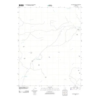
2011 Map of Cass Creek Peak
USGS Topo · Published 2011About this map
Mount Hillers and the surrounding high country of Garfield County define this 2011 topographic study. The landscape is marked by extreme elevation changes and drainage networks where seasonal water sources like Quaking Aspen Spring and Gold Creek Spring were critical for local ranching and transit. Significant landmarks including Cass Creek Peak and Bulldog Peak dominate the skyline, while water management is evidenced by the Bastian Reservoir and Cass Creek Reservoir.
Find a feature on this map
33 named features on this map. Tap any name to fly to it.
Don’t see what you’re looking for? This feature index may not catch every label — zoom into the map to look around manually.
Map Details
Editions of this 2011 Cass Creek Peak Map
This is the sole edition of this map. No revisions or reprints were ever made.
Other maps of this area

1885 · San Rafael
USGS Topo · 1:250,000

1886 · Henry Mountains
USGS Topo · 1:250,000

1892 · Henry Mountains
USGS Topo · 1:250,000

1952 · Mt Pennell 1 SW
USGS Topo · 1:24,000

1952 · Mount Ellen 4 SW
USGS Topo · 1:24,000

1952 · Mt Pennell 2 NE
USGS Topo · 1:24,000

1952 · Mt Pennell 1 NE
USGS Topo · 1:24,000

1952 · Mt Hillers
USGS Topo · 1:62,500

1952 · Mt Pennell 1 SE
USGS Topo · 1:24,000

1952 · Mt Pennell 1 NW
USGS Topo · 1:24,000