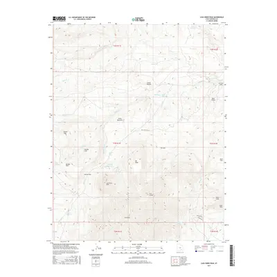
2017 Map of Cass Creek Peak
USGS Topo · Published 2017About this map
Henry Mountains dominate this high-desert landscape in Garfield County, punctuated by several significant peaks and water-management features. The map centers on Cass Creek Peak and the massive profile of Mt Hillers to the south. Historically essential water sources are dispersed throughout the arid terrain, including Bastian Reservoir, Cass Cr Reservoir, and several vital springs such as Quaking Aspen Spring and Gold Creek Spring. The geography is defined by sharp elevation changes, notably at Stanton Pass and along the Taylor Ridges. Cattle ranching and backcountry navigation are evidenced by landmarks like Coyote Benches and named drainages such as Benson Cr and Straight Cr. Access through this remote section of the Colorado Plateau is traced via the unpaved Bull Creek Pass Rd and Trailcreek Rd.
Find a feature on this map
44 named features on this map. Tap any name to fly to it.
Don’t see what you’re looking for? This feature index may not catch every label — zoom into the map to look around manually.
Map Details
Editions of this 2017 Cass Creek Peak Map
This is the sole edition of this map. No revisions or reprints were ever made.
Other maps of this area

1885 · San Rafael
USGS Topo · 1:250,000

1886 · Henry Mountains
USGS Topo · 1:250,000

1892 · Henry Mountains
USGS Topo · 1:250,000

1952 · Mt Pennell 1 SW
USGS Topo · 1:24,000

1952 · Mount Ellen 4 SW
USGS Topo · 1:24,000

1952 · Mt Pennell 2 NE
USGS Topo · 1:24,000

1952 · Mt Pennell 1 NE
USGS Topo · 1:24,000

1952 · Mt Hillers
USGS Topo · 1:62,500

1952 · Mt Pennell 1 SE
USGS Topo · 1:24,000

1952 · Mt Pennell 1 NW
USGS Topo · 1:24,000