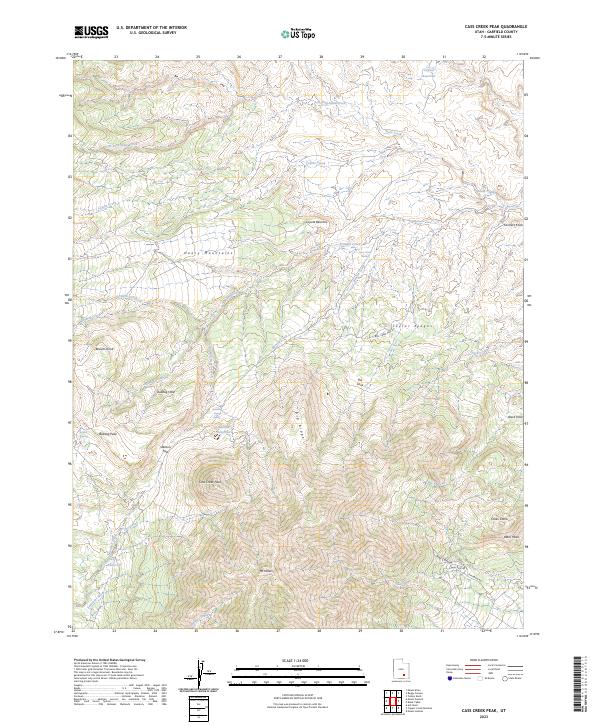
2023 Map of Cass Creek Peak
USGS Topo · Published 2023About this map
Mt Hillers and Cass Creek Peak dominate the high-elevation landscape of the Henry Mountains in Garfield County, Utah. This modern topographic record details a rugged environment defined by sharp elevation changes and essential water sources, including Bastian Reservoir and the Cass Cr Reservoir fed by Cass Creek. The complex drainage network is visible through numerous seasonal and perennial flows like Coyote Creek, Benson Creek, and the Saleratus Wash, which have carved distinctive formations such as the Coyote Benches and Taylor Ridges. Navigational routes through this terrain are anchored by named crossings and passes, most notably Stanton Pass and the winding Bull Creek Pass Rd. Geologic interest is evident in features like Cocks Comb and Black Mesa, while local landmarks such as Bulldog Hole and Farmers Knob reflect the naming conventions of those who have navigated these peaks and valleys.
Find a feature on this map
40 named features on this map. Tap any name to fly to it.
Don’t see what you’re looking for? This feature index may not catch every label — zoom into the map to look around manually.
Map Details
Editions of this 2023 Cass Creek Peak Map
This is the sole edition of this map. No revisions or reprints were ever made.
Other maps of this area

1885 · San Rafael
USGS Topo · 1:250,000

1886 · Henry Mountains
USGS Topo · 1:250,000

1892 · Henry Mountains
USGS Topo · 1:250,000

1952 · Mt Pennell 1 SW
USGS Topo · 1:24,000

1952 · Mount Ellen 4 SW
USGS Topo · 1:24,000

1952 · Mt Pennell 2 NE
USGS Topo · 1:24,000

1952 · Mt Pennell 1 NE
USGS Topo · 1:24,000

1952 · Mt Hillers
USGS Topo · 1:62,500

1952 · Mt Pennell 1 SE
USGS Topo · 1:24,000

1952 · Mt Pennell 1 NW
USGS Topo · 1:24,000