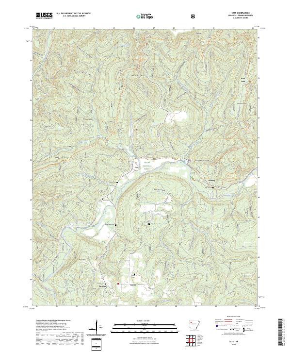
2024 Map of Cass
USGS Topo · Published 2024About this map
The Mulberry Wild and Scenic River carves a deep path through the Ozark National Forest, anchoring a landscape defined by steep ridges and narrow hollows. In this corner of Franklin County, small settlements like Cass, Redding, and Paradise sit along the winding watercourse and the adjacent highlands. The map reveals a dense network of family-named cemeteries, including Mclroy Cem, Turner Cem, and Childers Cem, which serve as vital markers for genealogical research in this sparsely populated terrain. High elevations such as Whiting Mtn and Morgan Mtn loom over local drainages like Barron Creek and Fane Creek. Modern recreation is represented by the Ozark Highlands Trl, yet the map also preserves older rural connections through routes like Cass Oark Rd and Barnes Rd, reflecting the enduring settlement patterns of the Ozark interior.
Find a feature on this map
79 named features on this map. Tap any name to fly to it.
Don’t see what you’re looking for? This feature index may not catch every label — zoom into the map to look around manually.
Map Details
Editions of this 2024 Cass Map
This is the sole edition of this map. No revisions or reprints were ever made.
Other maps of this area

1879 · Cravens
USGS Topo · 1:62,500

1887 · Watalula
USGS Topo · 1:62,500

1906 · Batson
USGS Topo · 1:62,500

1939 · Watalula
USGS Topo · 1:62,500

1943 · St. Paul
USGS Topo · 1:62,500

1946 · St. Paul
USGS Topo · 1:62,500

1956 · Russellville
USGS Topo · 1:250,000
1963 · Hunt
USGS Topo · 1:24,000

1964 · Russellville
USGS Topo · 1:250,000
1973 · Cravens
USGS Topo · 1:24,000