
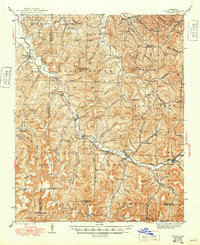
1946 Map of St. Paul
USGS Topo · Published 1946About this map
White River headwaters wind through the deep ridges of Ozark National Forest on this 1940s survey of southern Madison County. The map documents a dense network of mountain schools and cemeteries that once served these isolated hollows. From St Paul and Brashears Junction in the southeast to small settlements like Delaney and Patrick, the landscape is defined by its social topography. Local genealogists will find significant value in the distribution of family-named landmarks and rural institutions, including Good Luck Sch, Mountain View Sch, and Shumate Ch. The cartography captures the region before extensive modernization, showing the rugged connection between the White River valley and the high summits of Bristle Mtn and Potato Knob.
Find a feature on this map
106 named features on this map. Tap any name to fly to it.
Don’t see what you’re looking for? This feature index may not catch every label — zoom into the map to look around manually.
Map Details
Editions of this 1946 St. Paul Map
2 editions found
Other maps of this area

1879 · Cravens
USGS Topo · 1:62,500

1887 · Watalula
USGS Topo · 1:62,500

1898 · Winslow #4
USGS Topo · 1:62,500

1898 · Winslow
USGS Topo · 1:125,000

1899 · Fayetteville
USGS Topo · 1:125,000

1900 · Eureka Springs
USGS Topo · 1:125,000

1901 · Winslow
USGS Topo · 1:125,000

1901 · Eureka Springs
USGS Topo · 1:125,000

1901 · Fayetteville
USGS Topo · 1:125,000

1904 · Fayetteville
USGS Topo · 1:125,000