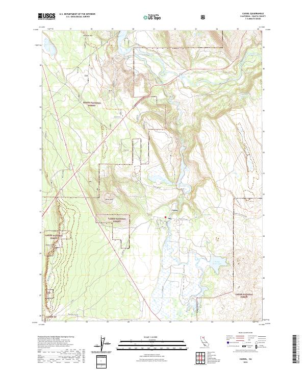
2021 Map of Cassel
USGS Topo · Published 2021About this map
Cassel lies at the junction of significant water systems in eastern Shasta County, where the waters of Hat Creek and the Pit River shape the local geography. This high-country landscape is defined by the overlap of two major public lands, with Shasta National Forest covering the northern reaches and Lassen National Forest extending to the south. The hydrography here is notably intricate, featuring Rising River Lake and the wetlands of the Hat Creek Valley, which historically supported the region's agricultural and power-generation needs. Transportation through this terrain follows the Pacific Crest National Scenic Trl, which winds north-to-south, crossing over Brush Mtn and passing near the Chalk Reservoir. Locally named landmarks like Arknight Flat and Rock Spring suggest long-standing rural usage and grazing patterns within the forest boundaries.
Find a feature on this map
38 named features on this map. Tap any name to fly to it.
Don’t see what you’re looking for? This feature index may not catch every label — zoom into the map to look around manually.
Map Details
Editions of this 2021 Cassel Map
This is the sole edition of this map. No revisions or reprints were ever made.
Other maps of this area

1886 · Lassen Peak
USGS Topo · 1:250,000

1886 · Modoc Lava Bed
USGS Topo · 1:250,000

1892 · Modoc Lava-Bed
USGS Topo · 1:250,000

1892 · Lassen Peak
USGS Topo · 1:250,000

1894 · Lassen Peak
USGS Topo · 1:250,000

1932 · Bartle
USGS Topo · 1:96,000

1935 · Burney
USGS Topo · 1:96,000

1939 · Burney
USGS Topo · 1:125,000

1939 · Halls Flat
USGS Topo · 1:125,000

1939 · Bartle
USGS Topo · 1:125,000