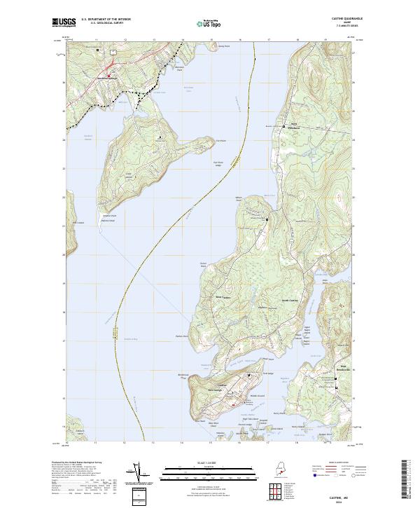
2024 Map of Castine
USGS Topo · Published 2024About this map
Castine and the surrounding coastline of the Penobscot River estuary are defined by a complex maritime geography where the land meets the Penobscot Bay. The village of Castine itself is situated on a peninsula between Wadsworth Cove and Castine Harbor, marked by the presence of Fort George and the Maine Maritime Academy. The map reveals a landscape of points and ledges, such as Dice Head and Trott Ledge, that have historically dictated the navigation of these waters. Across the Bagaduce River, the village of West Brooksville contains the West Brooksville Congregational Church and the Blodgett Family Cem, reflecting the enduring local genealogy of the area.
Find a feature on this map
128 named features on this map. Tap any name to fly to it.
Don’t see what you’re looking for? This feature index may not catch every label — zoom into the map to look around manually.
Map Details
Editions of this 2024 Castine Map
This is the sole edition of this map. No revisions or reprints were ever made.
Other maps of this area

1900 · Orland
USGS Topo · 1:62,500

1900 · Bucksport
USGS Topo · 1:62,500

1902 · Bucksport
USGS Topo · 1:62,500

1902 · Castine
USGS Topo · 1:62,500

1904 · Castine
USGS Topo · 1:62,500

1904 · Bluehill
USGS Topo · 1:62,500

1905 · Penobscot Bay
USGS Topo · 1:125,000

1941 · Castine
USGS Topo · 1:62,500

1942 · Orland
USGS Topo · 1:62,500

1942 · Bucksport
USGS Topo · 1:62,500