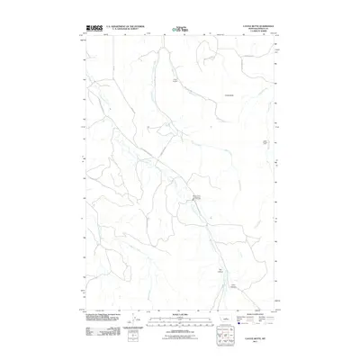
2011 Map of Castle Butte
USGS Topo · Published 2011About this map
Castle Butte and the surrounding rangelands of Fergus County are defined by a network of drainage systems including Cottonwood Creek, Casino Creek, and Mill Creek. This 2011 survey illustrates a sparsely populated landscape where modern infrastructure and recreational sites are integrated into the canyon-carved terrain. Camp Lewtana sits along the upper reaches of Mill Creek, while the Castle Hill Ski Area occupies the slopes on the eastern edge of the quadrangle. The map reveals the critical importance of regional services in this open country, specifically marking the Beaver Creek - Cottonwood Rural Fire Dist station. A series of deep incisions in the land, such as Hay Canyon and Lyon Canyon, trace the path toward the larger Beaver Creek drainage in the south.
Find a feature on this map
21 named features on this map. Tap any name to fly to it.
Don’t see what you’re looking for? This feature index may not catch every label — zoom into the map to look around manually.
Map Details
Editions of this 2011 Castle Butte Map
This is the sole edition of this map. No revisions or reprints were ever made.
Other maps of this area

1889 · Big Snowy Mountain
USGS Topo · 1:250,000

1893 · Big Snowy Mountain
USGS Topo · 1:250,000

1941 · Lewistown
USGS Topo · 1:62,500

1944 · Lewistown
USGS Topo · 1:62,500

1954 · Roundup
USGS Topo · 1:250,000

1954 · Lewistown
USGS Topo · 1:250,000

1958 · Roundup
USGS Topo · 1:250,000

1959 · Lewistown
USGS Topo · 1:250,000

1970 · Glengarry
USGS Topo · 1:24,000

1970 · Crystal Lake
USGS Topo · 1:24,000