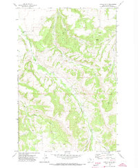
1970 Map of Castle Butte
USGS Topo · Published 1973About this map
Castle Butte and the surrounding Fergus County terrain are defined by a network of drainage systems feeding into Cottonwood Creek and Casino Creek. This 1970 field-checked survey reveals a landscape largely dedicated to ranching and recreation, evidenced by the Castle Hill Ski Area and the remote Camp Lewistown site tucked near Mill Creek. The map shows a clear transition between the valley floors, where the Cottonwood Sch sits along the water, and the rising elevations of Hay Canyon and Lyon Canyon to the south.
Find a feature on this map
18 named features on this map. Tap any name to fly to it.
Don’t see what you’re looking for? This feature index may not catch every label — zoom into the map to look around manually.
Map Details
Editions of this 1970 Castle Butte Map
This is the sole edition of this map. No revisions or reprints were ever made.
Other maps of this area

1889 · Big Snowy Mountain
USGS Topo · 1:250,000

1893 · Big Snowy Mountain
USGS Topo · 1:250,000

1941 · Lewistown
USGS Topo · 1:62,500

1944 · Lewistown
USGS Topo · 1:62,500

1954 · Roundup
USGS Topo · 1:250,000

1954 · Lewistown
USGS Topo · 1:250,000

1958 · Roundup
USGS Topo · 1:250,000

1959 · Lewistown
USGS Topo · 1:250,000

1970 · Glengarry
USGS Topo · 1:24,000

1970 · Crystal Lake
USGS Topo · 1:24,000