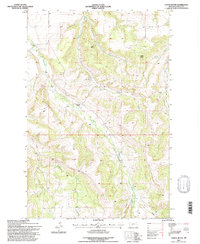
1995 Map of Castle Butte
USGS Topo · Published 1997About this map
Camp Lewtana and the Cottonwood School anchor this landscape in central Montana, reflecting the area's mid-century community life. The terrain is defined by the prominent Castle Butte and several significant drainages, including Cottonwood Creek, Casino Creek, and Beaver Creek. These waterways and their surrounding canyons, such as Hay Canyon and Lyon Canyon, trace the natural transit corridors and drainage patterns of the Fergus County high country.
Find a feature on this map
16 named features on this map. Tap any name to fly to it.
Don’t see what you’re looking for? This feature index may not catch every label — zoom into the map to look around manually.
Map Details
Editions of this 1995 Castle Butte Map
This is the sole edition of this map. No revisions or reprints were ever made.
Other maps of this area

1889 · Big Snowy Mountain
USGS Topo · 1:250,000

1893 · Big Snowy Mountain
USGS Topo · 1:250,000

1941 · Lewistown
USGS Topo · 1:62,500

1944 · Lewistown
USGS Topo · 1:62,500

1954 · Roundup
USGS Topo · 1:250,000

1954 · Lewistown
USGS Topo · 1:250,000

1958 · Roundup
USGS Topo · 1:250,000

1959 · Lewistown
USGS Topo · 1:250,000

1970 · Glengarry
USGS Topo · 1:24,000

1970 · Crystal Lake
USGS Topo · 1:24,000