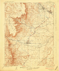
1925 Map of Castle Dale
USGS Topo · Published 1925About this map
Castle Dale and the surrounding Emery County settlements are captured here during a period of transition in the 1920s, showing a landscape defined by irrigation and early industry. The map illustrates the extensive network of ditches, such as the Johnson Ditch, that enabled agriculture on the numerous plateaus like Danish Bench and Buzzard Bench. The presence of the Ferron Mill and the Killpack Mine highlights the local processing and extraction economies that supported towns like Ferron and Orangeville.
Find a feature on this map
43 named features on this map. Tap any name to fly to it.
Don’t see what you’re looking for? This feature index may not catch every label — zoom into the map to look around manually.
Map Details
Editions of this 1925 Castle Dale Map
2 editions found

Other maps of this area

1885 · San Rafael
USGS Topo · 1:250,000

1885 · Manti
USGS Topo · 1:250,000

1885 · Fish Lake
USGS Topo · 1:250,000

1886 · Price River
USGS Topo · 1:250,000

1895 · Manti
USGS Topo · 1:250,000

1896 · Price River
USGS Topo · 1:250,000

1896 · Fish Lake
USGS Topo · 1:250,000

1922 · Wasatch
USGS Topo · 1:31,680

1923 · Castle Dale
USGS Topo · 1:62,500

1923 · Hiawatha
USGS Topo · 1:62,500